Air Ambulance Helicopter to Carlisle
Sunday, 3 May 2026 | 19:51 | From Loweswater
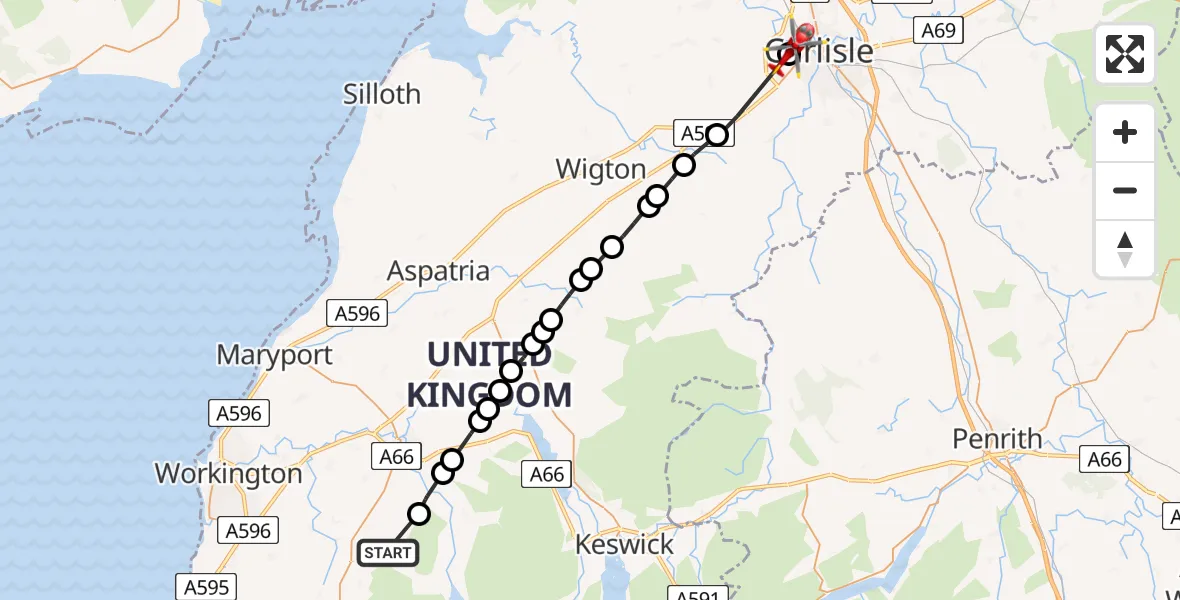
On Sunday, 3 May 2026 at 19:51, a Air Ambulance Helicopter departed from Loweswater to Carlisle. It was the Air Ambulance Helicopter with registration number G-NHAE. The flight lasted 11 minutes. During that period, the aircraft travelled 27 miles at an average speed of 146 miles per hour at a maximum altitude of 1525 feet.
Helicopter: G-NHAE
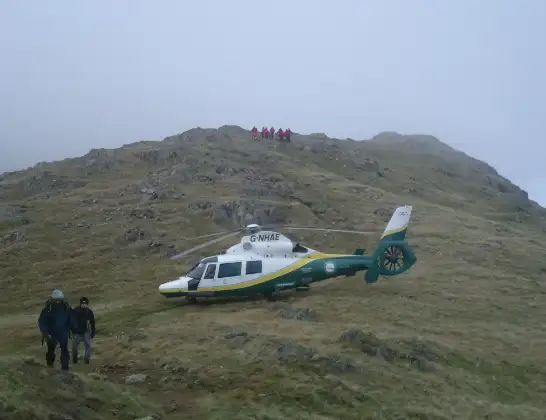
The helicopter G-NHAE is used as a air ambulance helicopter. The main purpose of this aircraft is to transport a Mobile Medical Team to an incident as quickly as possible, enabling the trauma doctor to provide immediate first aid on site. The aircraft is flying this flight as Air Ambulance Helicopter.
Photo: Michael Earnshaw
27 miles
1525 feet
146 mph
11 minutes
19:51
20:02

Route
Carlisle, Cumberland20:02
Carlisle, Cumberland20:02
Baldwinholme, Cumberland19:59
Thursby, Cumberland19:58
Westward, Cumberland19:58
Rosley, Cumberland19:58
Westward, Cumberland19:57
Boltons, Cumberland19:56
Mealsgate, Cumberland19:56
Ireby, Cumberland19:55
Sunderland, Cumberland19:55
Bewaldeth and Snittlegarth, Cumberland19:55
Sunderland, Cumberland19:54
Blindcrake, Cumberland19:54
Setmurthy, Cumberland19:53
Cockermouth, Cumberland19:53
Embleton, Cumberland19:52
Lorton, Cumberland19:52
Blindbothel, Cumberland19:51
Fangs Brow, Cumberland19:51
Live flights
Today
Police Helicopter to Hawarden Airport3 May 23:42
Coastguard Helicopter to Caernarfon Airport3 May 22:09
Police Helicopter to Boverton, Llanmaes3 May 22:05
Police Helicopter to Hawarden Airport3 May 21:56
Police Helicopter to Rockbeare, Silver Lane3 May 21:25
Flights Carlisle
Air Ambulance Helicopter to Carlisle3 May 19:51
Air Ambulance Helicopter to Carlisle, Brookside25 Apr 17:40
Air Ambulance Helicopter to Carlisle18 Apr 16:48
Flights Loweswater
Air Ambulance Helicopter to Carlisle3 May 19:51
Helicopter flights on your website?
You can easily display helicopter flights on your own website. Use the embed code.
