Air Ambulance Helicopter to Carlisle, Coledale Meadows
Sunday, 3 May 2026 | 15:33 | From High Lorton
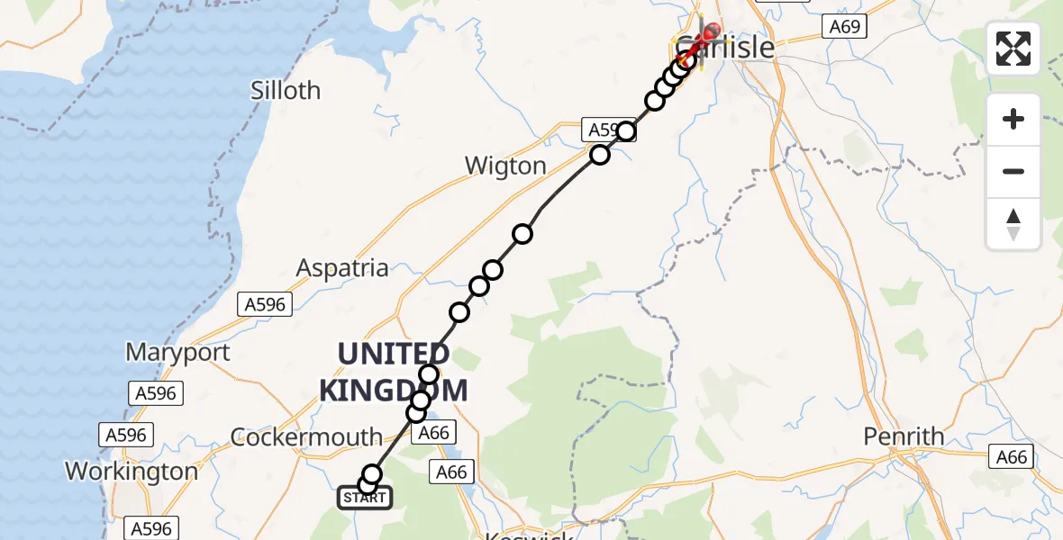
On Sunday, 3 May 2026 at 15:33, a Air Ambulance Helicopter departed from High Lorton to Carlisle. It was the Air Ambulance Helicopter with registration number G-NHAE. The flight lasted 10 minutes. During that period, the aircraft travelled 23 miles at an average speed of 135 miles per hour at a maximum altitude of 1500 feet.
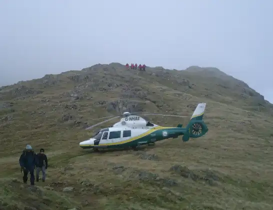
Helicopter: G-NHAE
The helicopter G-NHAE is used as a air ambulance helicopter. The main purpose of this aircraft is to transport a Mobile Medical Team to an incident as quickly as possible, enabling the trauma doctor to provide immediate first aid on site. The aircraft is flying this flight as Air Ambulance Helicopter.
Photo: Michael Earnshaw
24 miles
1500 feet
135 mph
11 minutes
15:33
15:44

Route
Coledale Meadows, Cumberland15:44
Carlisle, Cumberland15:43
Morton, Cumberland15:43
Dalston, Cumberland15:43
Little Orton, Cumberland15:42
Dalston, Cumberland15:42
Baldwinholme, Cumberland15:41
Thursby, Cumberland15:40
Westward, Cumberland15:39
Boltons, Cumberland15:38
Mealsgate, Cumberland15:37
Ireby, Cumberland15:37
Sunderland, Cumberland15:36
Blindcrake, Cumberland15:35
The Ruddings, Cumberland15:35
Embleton, Cumberland15:34
Lorton, Cumberland15:34
B5292, Cumberland15:33
Live flights
Today
Flights Carlisle
Air Ambulance Helicopter to Carlisle, Brookside21 Jun 11:43
Air Ambulance Helicopter to Carlisle, Brunel Way21 Jun 10:48
Air Ambulance Helicopter to Edenhall, B641218 Jun 20:04
Air Ambulance Helicopter to Skirwith18 Jun 13:47
Air Ambulance Helicopter to Carlisle, Brookside26 May 15:11
Helicopter flights on your website?
You can easily display helicopter flights on your own website. Use the embed code.
