Police Helicopter to Gawthorpe, Batley Road
Saturday, 2 May 2026 | 20:14 | From Ossett
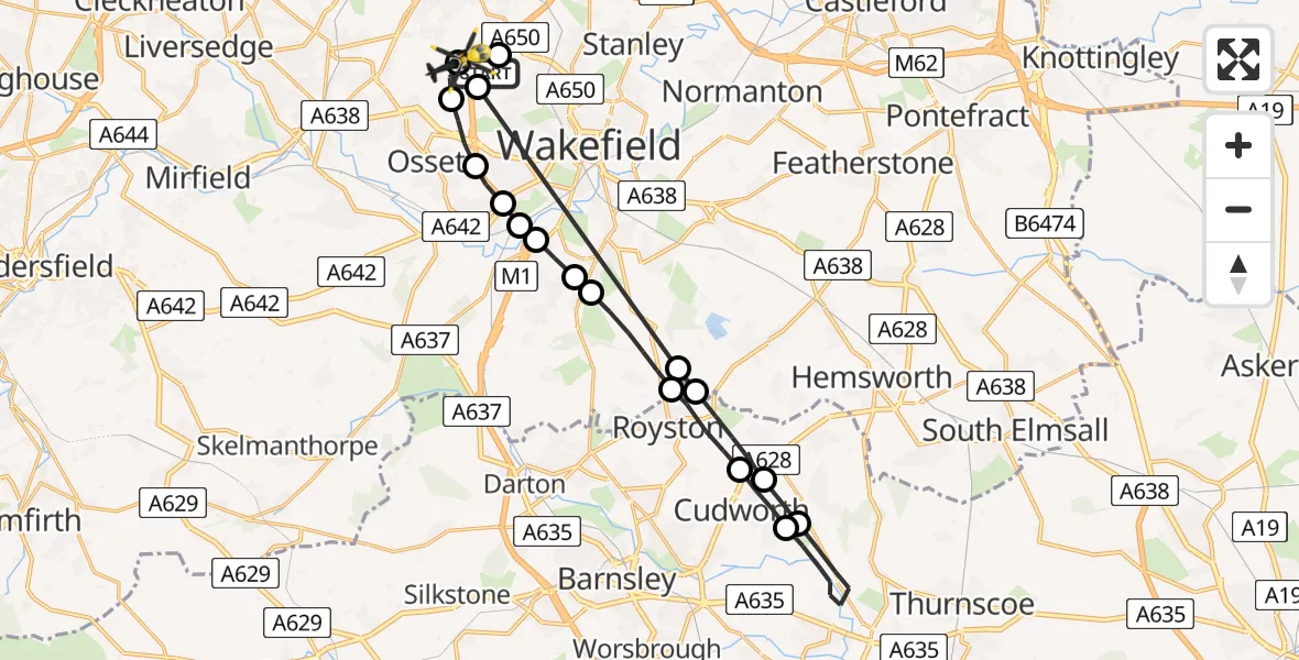
On Saturday, 2 May 2026 at 20:14, a Police Helicopter departed from Ossett to Gawthorpe. It was the Police Helicopter with registration number G-TVHB. The flight lasted 14 minutes. During that period, the aircraft travelled 30 miles at an average speed of 124 miles per hour at a maximum altitude of 1225 feet.
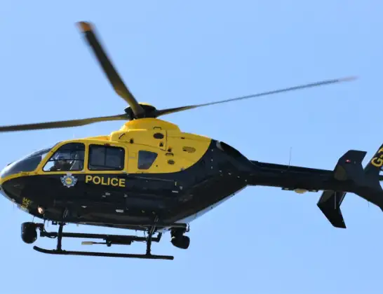
Helicopter: G-TVHB
The helicopter G-TVHB is used by the British police. The helicopter is deployed in pursuits, missing persons cases and other incidents where a helicopter provides added value.
Photo: Alec Wilson
30 miles
1225 feet
124 mph
15 minutes
20:14
20:28

Route
Batley Road, West Yorkshire - Leeds20:28
Wrenthorpe, Wakefield20:28
Woodkirk, Leeds20:27
Gawthorpe, Wakefield20:27
Ossett, Wakefield20:26
Horbury, Wakefield20:25
Calder Grove, Wakefield20:25
Durkar, Wakefield20:25
Kettlethorpe, Wakefield20:24
Newmillerdam, Wakefield20:24
Notton, Wakefield20:23
Barnsley, Barnsley20:22
Cudworth, Barnsley20:21
Barnsley, Barnsley20:19
Cudworth, Barnsley20:18
Barnsley, Barnsley20:17
Cold Hiendley, Wakefield20:17
Ossett, Wakefield20:14
Brandy Carr Road, West Yorkshire - Wakefield20:14
Live flights
Today
Flights Gawthorpe
Police Helicopter to Gawthorpe, Batley Road2 May 20:14
Police Helicopter to Gawthorpe, Owl Lane10 Apr 06:17
Police Helicopter to Gawthorpe, Owl Lane10 Apr 06:17
Police Helicopter to Gawthorpe, Owl Lane10 Apr 06:17
Police Helicopter to Gawthorpe, Owl Lane10 Apr 06:17
Police Helicopter to Gawthorpe, Owl Lane10 Apr 06:17
Police Helicopter to Gawthorpe, Owl Lane10 Apr 06:17
Police Helicopter to Gawthorpe, Owl Lane10 Apr 06:17
Police Helicopter to Gawthorpe, Owl Lane10 Apr 06:17
Police Helicopter to Gawthorpe, Owl Lane10 Apr 06:17
Flights Ossett
Police Helicopter to East Ardsley, Stoney Lane10 Jun 21:33
Police Helicopter to Wrenthorpe, Stoney Lane12 May 13:24
Police Helicopter to Ossett, Greenlay Drive12 May 13:20
Police Helicopter to Wrenthorpe, Stoney Lane7 May 02:12
Police Helicopter to Wrenthorpe, M16 May 16:40
Police Helicopter to Gawthorpe, Batley Road2 May 20:14
Police Helicopter to East Ardsley, Stoney Lane17 Apr 20:42
Helicopter flights on your website?
You can easily display helicopter flights on your own website. Use the embed code.
