Air Ambulance Helicopter to Edenhall
Saturday, 2 May 2026 | 17:46 | From Troutbeck
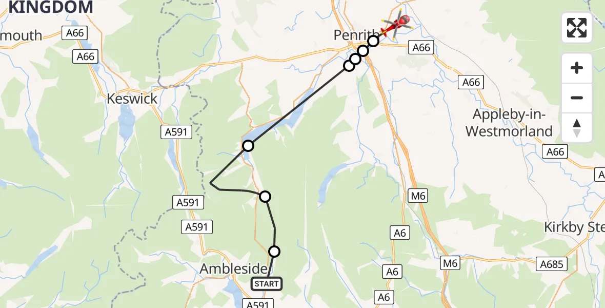
On Saturday, 2 May 2026 at 17:46, a Air Ambulance Helicopter departed from Troutbeck to Edenhall. It was the Air Ambulance Helicopter with registration number G-NHAE. The flight lasted 12 minutes. During that period, the aircraft travelled 27 miles at an average speed of 132 miles per hour at a maximum altitude of 2975 feet.
Helicopter: G-NHAE
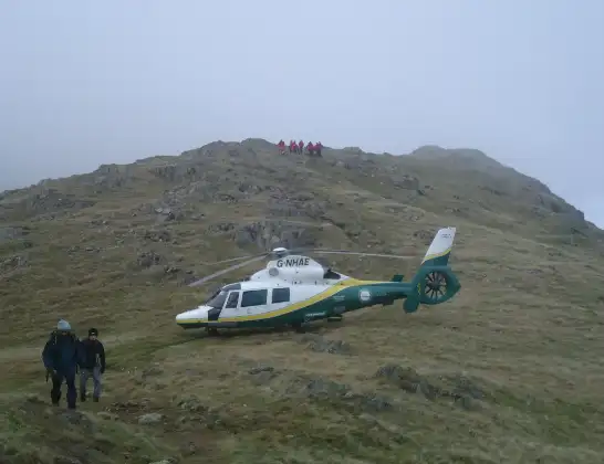
The helicopter G-NHAE is used as a air ambulance helicopter. The main purpose of this aircraft is to transport a Mobile Medical Team to an incident as quickly as possible, enabling the trauma doctor to provide immediate first aid on site. The aircraft is flying this flight as Air Ambulance Helicopter.
Photo: Michael Earnshaw
27 miles
2975 feet
132 mph
13 minutes
17:46
17:59

Route
Edenhall, Westmorland and Furness17:59
Penrith, Westmorland and Furness17:58
Eamont Bridge, Westmorland and Furness17:58
Yanwath, Westmorland and Furness17:57
Tirril, Westmorland and Furness17:57
Matterdale, Westmorland and Furness17:54
Patterdale, Westmorland and Furness17:49
Lakes, Westmorland and Furness17:47
Patterdale Road, Westmorland and Furness17:46
Live flights
Today
Flights Edenhall
Air Ambulance Helicopter to Skirwith1 Jul 09:53
Air Ambulance Helicopter to Kirkby Ireleth29 Jun 09:21
Air Ambulance Helicopter to Edenhall, B641228 Jun 15:45
Air Ambulance Helicopter to Edenhall, B641228 Jun 11:52
Air Ambulance Helicopter to Edenhall27 Jun 19:32
Air Ambulance Helicopter to Edenhall27 Jun 17:40
Flights Troutbeck
Air Ambulance Helicopter to Troutbeck, A59410 Jun 12:48
Air Ambulance Helicopter to Troutbeck, A669 Jun 17:03
Air Ambulance Helicopter to Edenhall2 May 17:46
Helicopter flights on your website?
You can easily display helicopter flights on your own website. Use the embed code.
