Police Helicopter to Boverton, Northern Access Road
Saturday, 2 May 2026 | 11:35 | From Pentre-chwyth
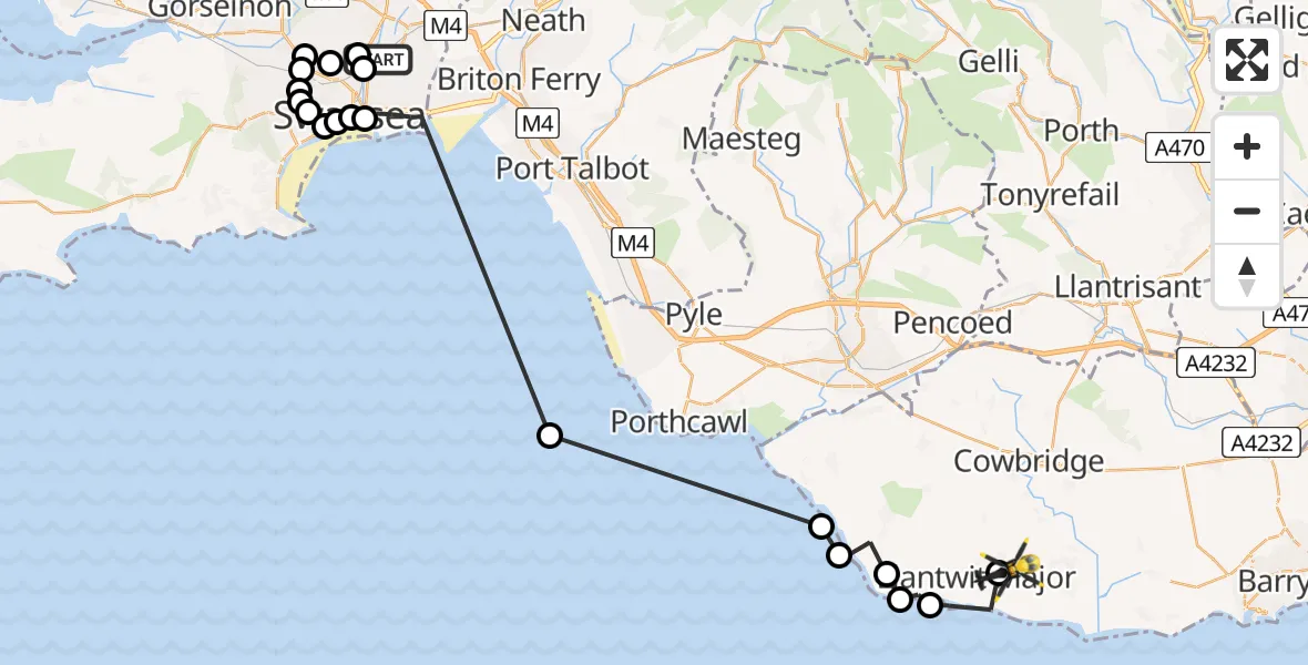
On Saturday, 2 May 2026 at 11:35, a Police Helicopter departed from Pentre-chwyth to Boverton. It was the Police Helicopter with registration number G-NWOI. The flight lasted 19 minutes. During that period, the aircraft travelled 38 miles at an average speed of 118 miles per hour at a maximum altitude of 1075 feet.
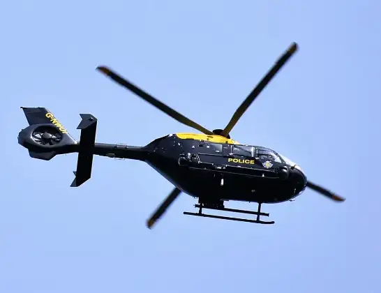
Helicopter: G-NWOI
The helicopter G-NWOI is used by the British police. The helicopter is deployed in pursuits, missing persons cases and other incidents where a helicopter provides added value.
Photo: Alec Wilson
38 miles
1075 feet
118 mph
20 minutes
11:35
11:54

Route
Northern Access Road, Vale of Glamorgan11:54
Boverton, Vale of Glamorgan11:54
Llantwit Major, Vale of Glamorgan11:53
St Donats, Vale of Glamorgan11:52
Marcross, Vale of Glamorgan11:52
Monknash, Vale of Glamorgan11:51
St Brides Major, Vale of Glamorgan11:50
Bristol Channel11:47
Waterfront, Swansea11:40
Hafod, Swansea11:40
Mount Pleasant, Swansea11:40
Brynmill, Swansea11:39
Mayhill, Swansea11:39
Tycoch, Swansea11:39
Waunarlwydd, Swansea11:39
Fforest-fach, Swansea11:38
Portmead, Swansea11:38
Gendros, Swansea11:38
Pentre-chwyth, Swansea11:36
Waun-Gron, Swansea11:35
Nantong Way, Swansea11:35
Live flights
Today
Flights Boverton
Police Helicopter to MOD St Athan30 Jul 18:22
Police Helicopter to Dinas, Brithweunydd Road29 Jul 21:51
Police Helicopter to MOD St Athan29 Jul 00:40
Police Helicopter to MOD St Athan28 Jul 18:07
Police Helicopter to Crofty25 Jul 19:37
Police Helicopter to North Devon, Nutcombe Hill25 Jul 08:57
Police Helicopter to MOD St Athan25 Jul 02:38
Police Helicopter to Tredegar, Manmoel Road24 Jul 20:00
Flights Pentre-chwyth
Helicopter flights on your website?
You can easily display helicopter flights on your own website. Use the embed code.
