Air Ambulance Helicopter to Fen Ditton, High Ditch Road
Saturday, 2 May 2026 | 11:20 | From Graveley
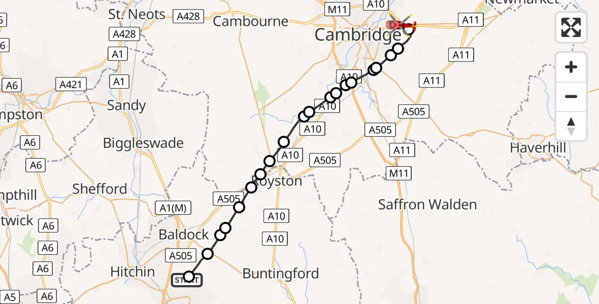
On Saturday, 2 May 2026 at 11:20, a Air Ambulance Helicopter departed from Graveley to Fen Ditton. It was the Air Ambulance Helicopter with registration number G-SCAA. The flight lasted 11 minutes. During that period, the aircraft travelled 28 miles at an average speed of 148 miles per hour at a maximum altitude of 1350 feet.
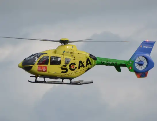
Helicopter: G-SCAA
The helicopter G-SCAA is used as a air ambulance helicopter. The main purpose of this aircraft is to transport a Mobile Medical Team to an incident as quickly as possible, enabling the trauma doctor to provide immediate first aid on site. The aircraft is flying this flight as Air Ambulance Helicopter.
Photo: Jonathan Payne
28 miles
1350 feet
148 mph
12 minutes
11:20
11:32

Route
High Ditch Road, Cambridgeshire11:32
Stow cum Quy, Cambridgeshire11:31
South Cambridgeshire, Cambridgeshire11:30
Cambridge, Cambridgeshire11:30
Great Shelford, Cambridgeshire11:29
Cambridge, Cambridgeshire11:29
Great Shelford, Cambridgeshire11:28
Hauxton, Cambridgeshire11:28
Harston, Cambridgeshire11:28
Foxton, Cambridgeshire11:28
Barrington, Cambridgeshire11:27
Shepreth, Cambridgeshire11:27
Meldreth, Cambridgeshire11:26
Bassingbourn cum Kneesworth, Cambridgeshire11:25
Royston, Hertfordshire11:24
Therfield, Hertfordshire11:24
North Hertfordshire, Hertfordshire11:23
Sandon, Hertfordshire11:22
North Hertfordshire, Hertfordshire11:22
Baldock, Hertfordshire11:21
Weston, Hertfordshire11:21
Back Lane, Hertfordshire11:20
Live flights
Today
Flights Graveley
Helicopter flights on your website?
You can easily display helicopter flights on your own website. Use the embed code.
