Police Helicopter to Shotts, Burnbrae Road
Saturday, 2 May 2026 | 11:13 | From Knowton Farm
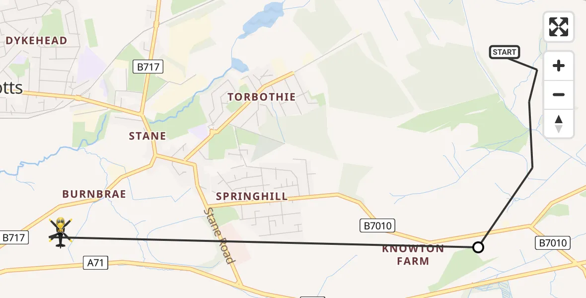
On Saturday, 2 May 2026 at 11:13, a Police Helicopter departed from Knowton Farm to Shotts. It was the Police Helicopter with registration number G-POLS. The flight lasted 5 minutes. During that period, the aircraft travelled 3 miles at an average speed of 37 miles per hour at a maximum altitude of 1750 feet.

Helicopter: G-POLS
The helicopter G-POLS is used by the British police. The helicopter is deployed in pursuits, missing persons cases and other incidents where a helicopter provides added value.
Photo: James from Cheltenham, Gloucestershire
4 miles
1750 feet
37 mph
6 minutes
11:13
11:18

Route
Burnbrae Road, North Lanarkshire11:18
Shotts, North Lanarkshire11:15
Knowton Farm, North Lanarkshire11:13
Live flights
Today
Flights Shotts
Police Helicopter to Upperton, B8032 May 11:20
Police Helicopter to Shotts, Burnbrae Road2 May 11:13
Police Helicopter to Shotts, Laggan Avenue26 Apr 17:21
Police Helicopter to Shotts, Stane Road26 Apr 17:18
Police Helicopter to Glasgow City Heliport30 Mar 21:02
Police Helicopter to Shotts, Burnbrae Road30 Mar 20:42
Helicopter flights on your website?
You can easily display helicopter flights on your own website. Use the embed code.
