Air Ambulance Helicopter to West Bridgford, Tollerton Lane
Thursday, 30 April 2026 | 19:03 | From Nottingham City Airport
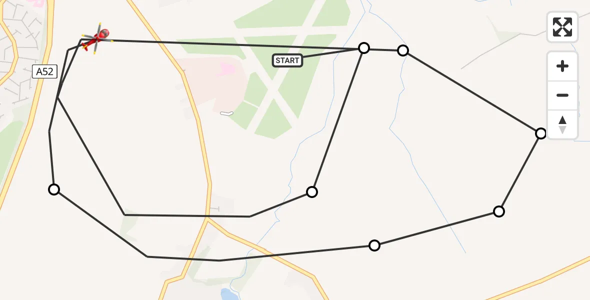
On Thursday, 30 April 2026 at 19:03, a Air Ambulance Helicopter departed from Nottingham City Airport to West Bridgford. It was the Air Ambulance Helicopter with registration number G-DRLA. The flight lasted 8 minutes. During that period, the aircraft travelled 7 miles at an average speed of 50 miles per hour at a maximum altitude of 475 feet.
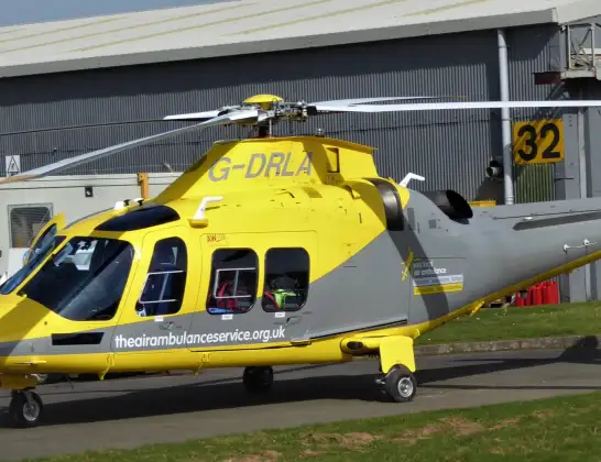
Helicopter: G-DRLA
The helicopter G-DRLA is used as an ambulance helicopter. The helicopter is equipped with a stretcher for transporting patients. The helicopter is often used to transport to hospitals.
Photo: Alec Wilson
7 miles
475 feet
50 mph
9 minutes
19:03
19:11

Route
Tollerton Lane, Nottinghamshire19:11
West Bridgford, Nottinghamshire19:11
Tollerton, Nottinghamshire19:10
Clipston, Nottinghamshire19:10
Cotgrave, Nottinghamshire19:09
Tollerton, Nottinghamshire19:09
West Bridgford, Nottinghamshire19:04
Tollerton, Nottinghamshire19:03
Nottingham City Airport, Nottingham19:03
Live flights
Police Helicopter on its way from Kenton30 Apr 23:54
Air Ambulance Aircraft on its way from North Sea30 Apr 23:48
Police Helicopter on its way from Chingford30 Apr 23:36
Today
Police Helicopter to MOD St Athan30 Apr 23:58
Air Ambulance Helicopter to Glasgow Airport30 Apr 23:40
Police Helicopter to East Ardsley, Stoney Lane30 Apr 22:56
Police Helicopter to Redhill Aerodrome30 Apr 22:30
Coastguard Helicopter to Stornoway Airport30 Apr 22:29
Coastguard Helicopter to Inner Seas30 Apr 22:24
Police Helicopter to East Ardsley, Stoney Lane30 Apr 22:22
Helicopter flights on your website?
You can easily display helicopter flights on your own website. Use the embed code.
