Air Ambulance Helicopter to Poole, Whitecliff Road
Thursday, 30 April 2026 | 16:45 | From Stanbridge
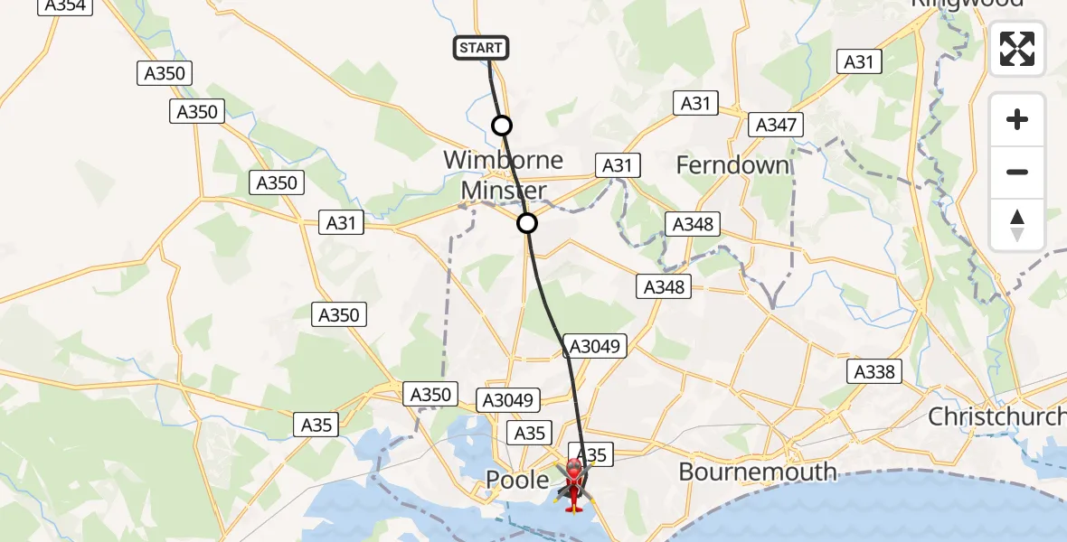
On Thursday, 30 April 2026 at 16:45, a Air Ambulance Helicopter departed from Stanbridge to Poole. It was the Air Ambulance Helicopter with registration number G-DSAA. The flight lasted 8 minutes. During that period, the aircraft travelled 10 miles at an average speed of 74 miles per hour at a maximum altitude of 875 feet.
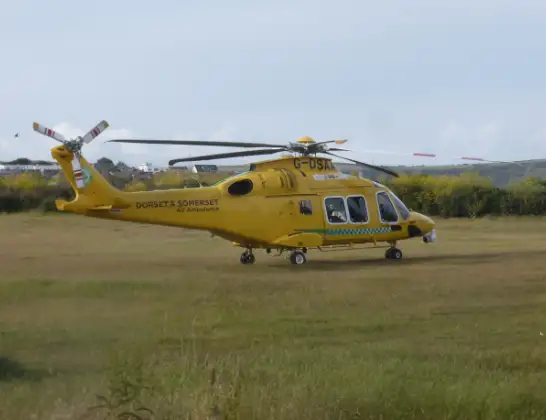
Helicopter: G-DSAA
The helicopter G-DSAA is used as a air ambulance helicopter. The main purpose of this aircraft is to transport a Mobile Medical Team to an incident as quickly as possible, enabling the trauma doctor to provide immediate first aid on site. The aircraft is flying this flight as Air Ambulance Helicopter.
Photo: Andrew Bone
11 miles
875 feet
74 mph
9 minutes
16:45
16:53

Route
Whitecliff Road, Bournemouth, Christchurch and Poole16:53
Whitecliff Road, Bournemouth, Christchurch and Poole16:53
Whitecliff Road, Bournemouth, Christchurch and Poole16:52
Poole, Bournemouth, Christchurch and Poole16:48
Wimborne Minster, Dorset16:47
Stanbridge, Dorset16:46
Stanbridge, Dorset16:45
Today
Coastguard Helicopter to Inverness Airport29 Jul 23:41
Flights Poole
Air Ambulance Helicopter to Henstridge Airfield21 Jul 14:43
Air Ambulance Helicopter to Poole, Banks Road21 Jul 13:12
Air Ambulance Helicopter to Henstridge Airfield15 Jul 02:12
Flights Stanbridge
Air Ambulance Helicopter to Stanbridge, B307830 Apr 15:47
Helicopter flights on your website?
You can easily display helicopter flights on your own website. Use the embed code.
