Air Ambulance Helicopter to Quarryford, U163
Thursday, 30 April 2026 | 14:48 | From Paxton
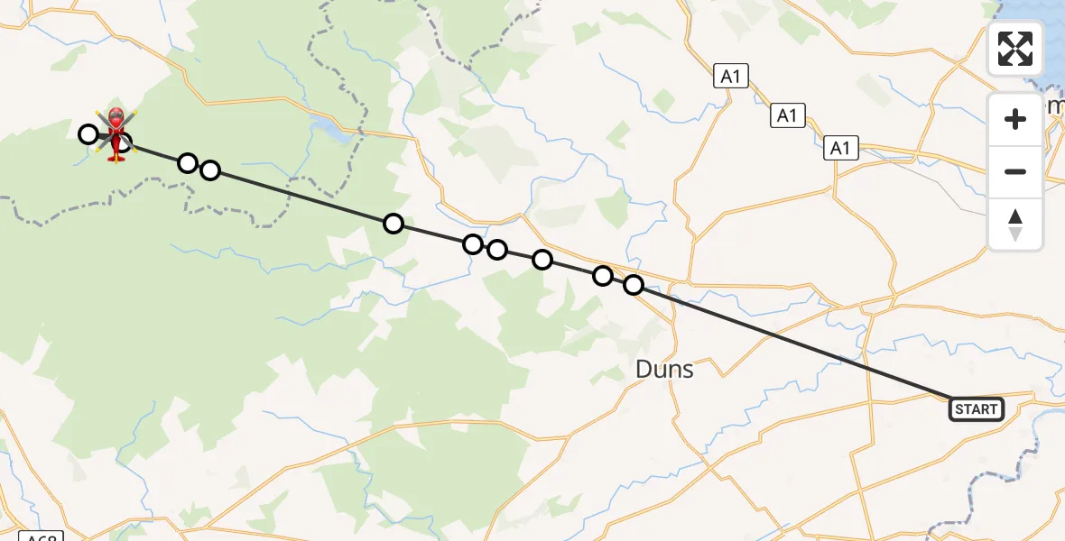
On Thursday, 30 April 2026 at 14:48, a Air Ambulance Helicopter departed from Paxton to Quarryford. It was the Air Ambulance Helicopter with registration number G-NHAE. The flight lasted 8 minutes. During that period, the aircraft travelled 24 miles at an average speed of 185 miles per hour at a maximum altitude of 1800 feet.
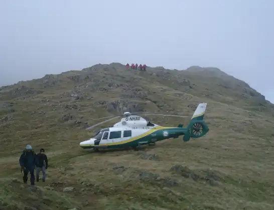
Helicopter: G-NHAE
The helicopter G-NHAE is used as a air ambulance helicopter. The main purpose of this aircraft is to transport a Mobile Medical Team to an incident as quickly as possible, enabling the trauma doctor to provide immediate first aid on site. The aircraft is flying this flight as Air Ambulance Helicopter.
Photo: Michael Earnshaw
24 miles
1800 feet
185 mph
8 minutes
14:48
14:55

Route
U163, East Lothian14:55
East Lothian, East Lothian14:55
Quarryford, East Lothian14:55
East Lothian, East Lothian14:54
Faseny Cottage, East Lothian14:54
Longformacus, Scottish Borders14:53
Fellcleugh, Scottish Borders14:52
Whitchester, Scottish Borders14:52
Windshiel, Scottish Borders14:51
Burnhouses, Scottish Borders14:51
Duns, Scottish Borders14:51
B6460, Scottish Borders14:48
Today
Coastguard Helicopter to Inverness Airport29 Jul 23:41
Flights Quarryford
Air Ambulance Helicopter to Quarryford, U16330 Apr 14:48
Flights Paxton
Air Ambulance Helicopter to Quarryford, U16330 Apr 14:48
Helicopter flights on your website?
You can easily display helicopter flights on your own website. Use the embed code.
