Air Ambulance Helicopter to Brougham, Edenhall
Wednesday, 29 April 2026 | 19:54 | From St. John's Castlerigg and Wythburn
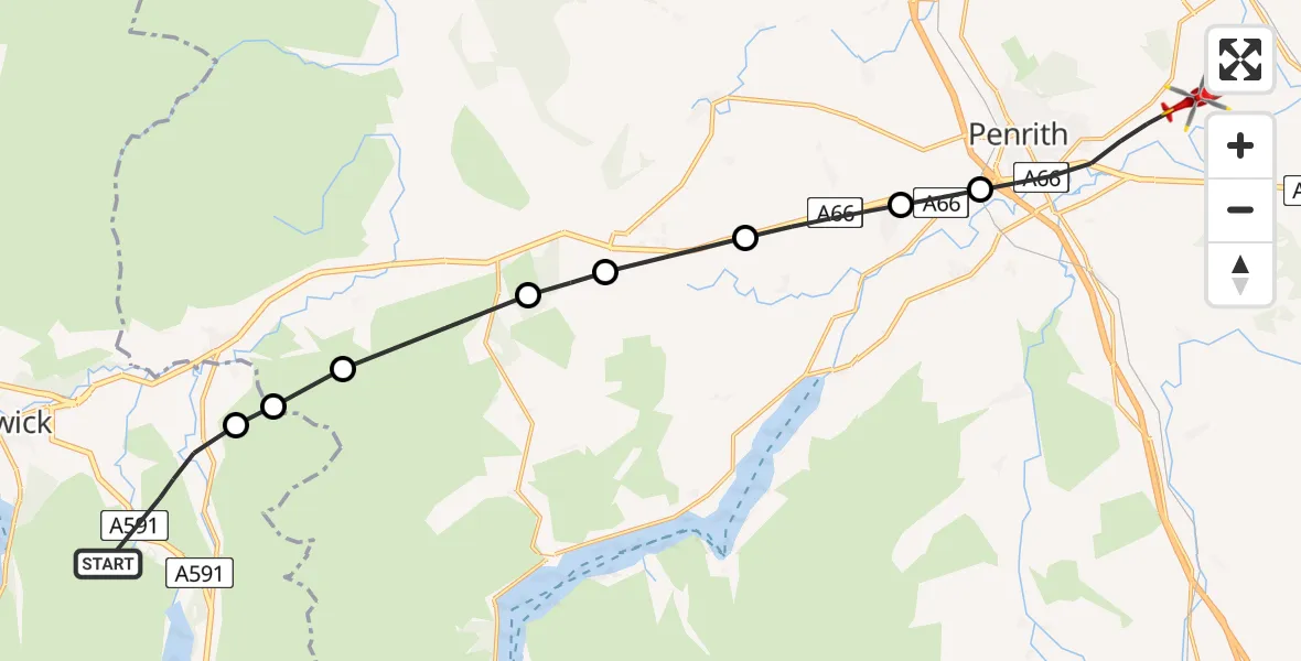
On Wednesday, 29 April 2026 at 19:54, a Air Ambulance Helicopter departed from St. John's Castlerigg and Wythburn to Brougham. It was the Air Ambulance Helicopter with registration number G-NHAE. The flight lasted 8 minutes. During that period, the aircraft travelled 18 miles at an average speed of 139 miles per hour at a maximum altitude of 2325 feet.
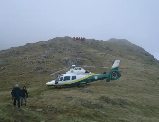
Helicopter: G-NHAE
The helicopter G-NHAE is used as a air ambulance helicopter. The main purpose of this aircraft is to transport a Mobile Medical Team to an incident as quickly as possible, enabling the trauma doctor to provide immediate first aid on site. The aircraft is flying this flight as Air Ambulance Helicopter.
Photo: Michael Earnshaw
19 miles
2325 feet
139 mph
8 minutes
19:54
20:02

Route
Edenhall, Westmorland and Furness20:02
Penrith, Westmorland and Furness20:00
Stainton, Westmorland and Furness19:59
Newbiggin, Westmorland and Furness19:58
Penruddock, Westmorland and Furness19:57
Hutton, Westmorland and Furness19:57
Matterdale, Westmorland and Furness19:56
Threlkeld, Westmorland and Furness19:55
Threlkeld, Cumberland19:55
St. John's Castlerigg and Wythburn, Cumberland19:54
Live flights
Today
Flights Brougham
Air Ambulance Helicopter to Cark airfield4 May 12:15
Air Ambulance Helicopter to Brougham, Edenhall29 Apr 19:54
Air Ambulance Helicopter to Brougham11 Apr 20:06
Helicopter flights on your website?
You can easily display helicopter flights on your own website. Use the embed code.
