Air Ambulance Helicopter to Dundonnell
Wednesday, 29 April 2026 | 16:00 | From Inverness
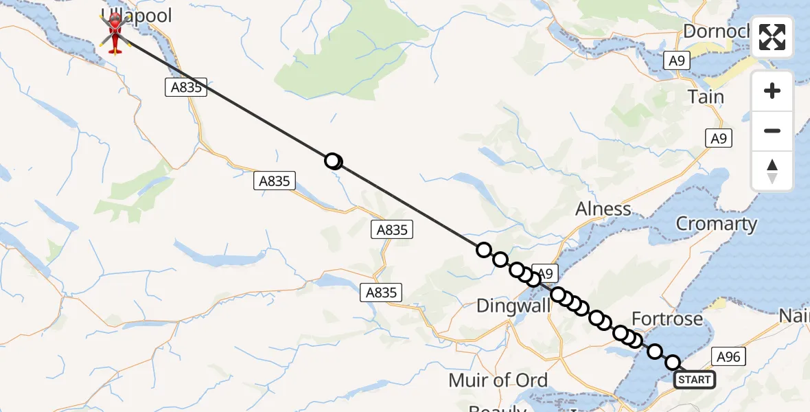
On Wednesday, 29 April 2026 at 16:00, a Air Ambulance Helicopter departed from Inverness to Dundonnell. It was the Air Ambulance Helicopter with registration number G-GSAS. The flight lasted 19 minutes. During that period, the aircraft travelled 48 miles at an average speed of 151 miles per hour at a maximum altitude of 8025 feet.
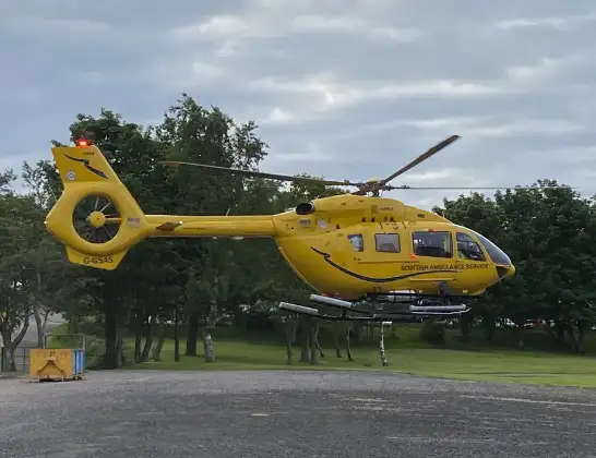
Helicopter: G-GSAS
The helicopter G-GSAS is used as a air ambulance helicopter. The main purpose of this aircraft is to transport a Mobile Medical Team to an incident as quickly as possible, enabling the trauma doctor to provide immediate first aid on site. The aircraft is flying this flight as Air Ambulance Helicopter.
Photo: Scanbus
49 miles
8025 feet
151 mph
20 minutes
16:00
16:19

Route
Dundonnell, Highland16:19
Loch Vaich16:13
Lubachlaggan, Highland16:12
Highland, Highland16:08
Dingwall, Highland16:07
Cnoc Tigh na Fhirich, Highland16:07
Highland, Highland16:07
Dingwall, Highland16:06
Culbokie, Highland16:06
Dingwall, Highland16:05
Culbokie, Highland16:05
Belmaduthy, Highland16:05
Killen, Highland16:04
Inverness, Highland16:04
Boat House, Highland16:04
Munlochy, Highland16:03
Bennetsfield Private Airstrip16:03
Avoch, Highland16:02
Fortrose, Highland16:01
A96, Highland16:00
Live flights
Today
Flights Dundonnell
Coastguard Helicopter to Mealabost1 May 21:51
Air Ambulance Helicopter to Dundonnell29 Apr 16:00
Coastguard Helicopter to Dundonnell24 Feb 17:08
Flights Inverness
Air Ambulance Helicopter to Inverness13 Jul 17:28
Coastguard Helicopter to Inverness Airport13 Jul 15:18
Coastguard Helicopter to Coire Sgreamhach12 Jul 17:55
Helicopter flights on your website?
You can easily display helicopter flights on your own website. Use the embed code.
