Air Ambulance Helicopter to Nottingham Heliport
Wednesday, 29 April 2026 | 13:36 | From Sinfin
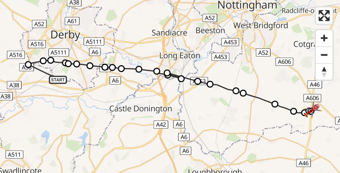
On Wednesday, 29 April 2026 at 13:36, a Air Ambulance Helicopter departed from Sinfin to Nottingham Heliport. It was the Air Ambulance Helicopter with registration number G-DRLA. The flight lasted 10 minutes. During that period, the aircraft travelled 27 miles at an average speed of 154 miles per hour at a maximum altitude of 825 feet.
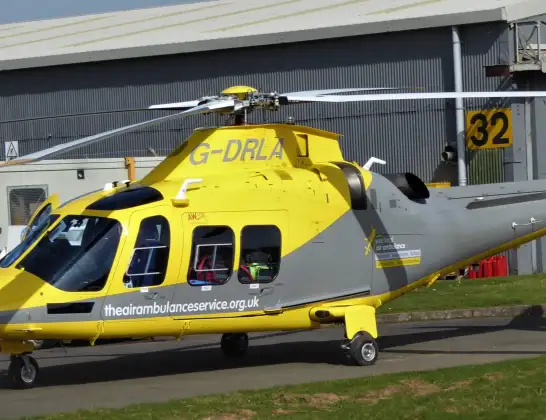
Helicopter: G-DRLA
The helicopter G-DRLA is used as an ambulance helicopter. The helicopter is equipped with a stretcher for transporting patients. The helicopter is often used to transport to hospitals.
Photo: Alec Wilson
27 miles
825 feet
154 mph
11 minutes
13:36
13:47

Route
Nottingham Heliport, 13:47
Nottingham Heliport13:47
Rushcliffe, Nottinghamshire13:46
Willoughby on the Wolds, Nottinghamshire13:46
Widmerpool, Nottinghamshire13:45
Wysall, Nottinghamshire13:45
Bunny, Nottinghamshire13:44
East Leake, Nottinghamshire13:43
Gotham, Nottinghamshire13:43
Thrumpton, Nottinghamshire13:42
Sawley, Derbyshire13:42
Long Eaton, Derbyshire13:42
Sawley, Derbyshire13:41
Breaston, Derbyshire13:41
Draycott, Derbyshire13:40
Ambaston, Derbyshire13:40
Elvaston, Derbyshire13:39
Alvaston, Derby13:39
Boulton, Derby13:39
Allenton, Derby13:38
Osmaston, Derby13:38
Sinfin, Derby13:38
Sunny Hill, Derby13:37
Heatherton, Derby13:37
Burnaston CP, Derbyshire13:37
Deep Dale Lane, Derby13:36
Live flights
Today
Flights Sinfin
Air Ambulance Helicopter to Nottingham Heliport29 Apr 13:36
Air Ambulance Helicopter to Sinfin, Elwick Road16 Apr 09:16
Helicopter flights on your website?
You can easily display helicopter flights on your own website. Use the embed code.
