Police Helicopter to Upper Minety, Flisteridge Road
Tuesday, 28 April 2026 | 9:48 | From Baydon
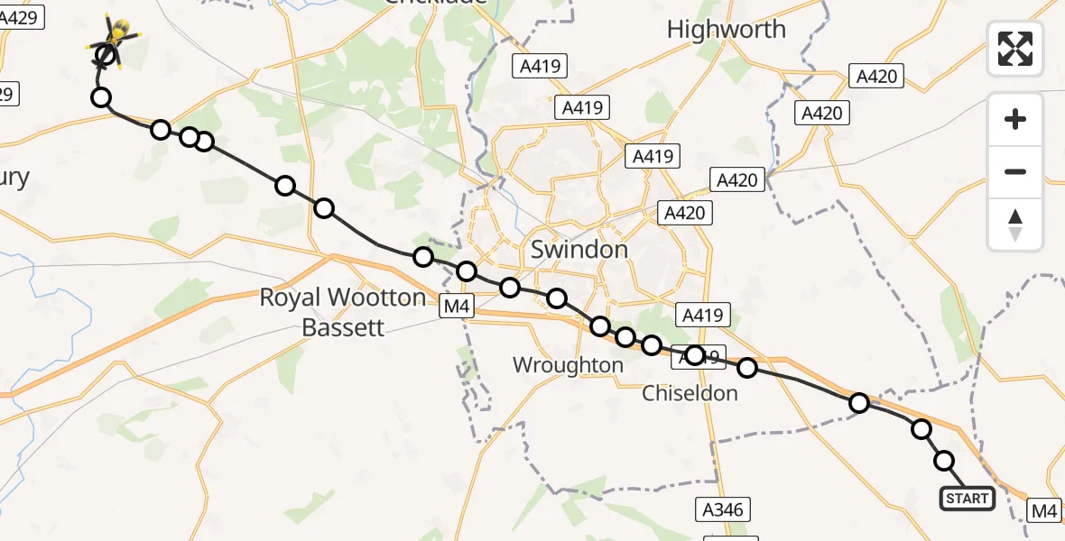
On Tuesday, 28 April 2026 at 9:48, a Police Helicopter departed from Baydon to Upper Minety. It was the Police Helicopter with registration number G-POLH. The flight lasted 11 minutes. During that period, the aircraft travelled 22 miles at an average speed of 117 miles per hour at a maximum altitude of 1075 feet.
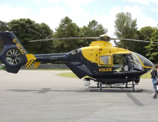
Helicopter: G-POLH
The helicopter G-POLH is used by the British police. The helicopter is deployed in pursuits, missing persons cases and other incidents where a helicopter provides added value.
Photo: Arpingstone
23 miles
1075 feet
117 mph
12 minutes
09:48
10:00

Route
Flisteridge Road, Wiltshire10:00
Upper Minety, Wiltshire10:00
Hankerton, Wiltshire09:59
Charlton, Wiltshire09:58
Malmesbury, Wiltshire09:58
Charlton, Wiltshire09:58
Purton, Wiltshire09:57
Swindon, Wiltshire09:56
Hook, Wiltshire09:55
Grange Park, Swindon09:54
Freshbrook, Swindon09:54
Wroughton, Swindon09:53
Swindon, Swindon09:53
Wroughton, Swindon09:53
Hodson, Swindon09:52
Badbury, Swindon09:52
Liddington, Swindon09:51
Wanborough, Swindon09:50
Baydon, Wiltshire09:49
Aldbourne Road, Wiltshire09:49
Baydon, Wiltshire09:48
Live flights
Today
Flights Baydon
Helicopter flights on your website?
You can easily display helicopter flights on your own website. Use the embed code.
