Air Ambulance Helicopter to Tonypandy, Upton Street
Tuesday, 28 April 2026 | 8:54 | From Dafen
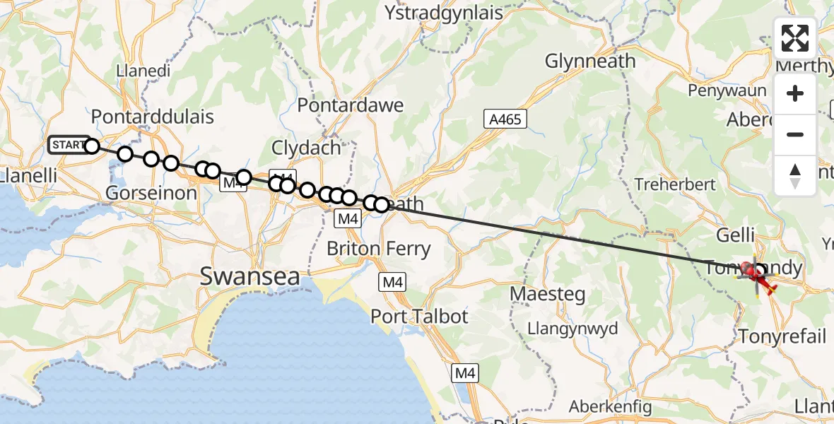
On Tuesday, 28 April 2026 at 8:54, a Air Ambulance Helicopter departed from Dafen to Tonypandy. It was the Air Ambulance Helicopter with registration number G-WYDN. The flight lasted 19 minutes. During that period, the aircraft travelled 31 miles at an average speed of 99 miles per hour at a maximum altitude of 1625 feet.

Helicopter: G-WYDN
The helicopter G-WYDN is used as a air ambulance helicopter. The main purpose of this aircraft is to transport a Mobile Medical Team to an incident as quickly as possible, enabling the trauma doctor to provide immediate first aid on site. The aircraft is flying this flight as Air Ambulance Helicopter.
Photo: Tony Melony
31 miles
1625 feet
99 mph
19 minutes
08:54
09:13

Route
Upton Street, Rhondda Cynon Taf09:13
Tonypandy, Rhondda Cynon Taf09:11
Neath, Neath Port Talbot09:02
Neath Abbey, Neath Port Talbot09:02
Skewen, Neath Port Talbot09:01
Coedffranc, Neath Port Talbot09:01
Birchgrove, Swansea09:01
Tregof, Swansea09:00
Ynystawe, Swansea09:00
Ynysforgan, Swansea08:59
Clase, Swansea08:59
Llangyfelach, Swansea08:58
Tircoed, Swansea08:58
Penllergaer, Swansea08:57
Gorseinon, Swansea08:56
Grovesend and Waungron, Swansea08:56
Heol Mwrwg, Carmarthenshire08:55
Dafen, Carmarthenshire08:54
Live flights
Today
Flights Tonypandy
Police Helicopter to Tonypandy, David Street8 Jun 20:01
Air Ambulance Helicopter to Tonypandy, A40589 May 10:41
Air Ambulance Helicopter to Cardiff Heliport12 Apr 16:33
Flights Dafen
Air Ambulance Helicopter to Dafen, Heol Aur15 Jun 19:01
Air Ambulance Helicopter to Dafen, Heol Aur15 Jun 18:53
Air Ambulance Helicopter to Dafen, Heol Aur15 Jun 16:33
Air Ambulance Helicopter to Dafen, Heol Aur15 Jun 10:15
Air Ambulance Helicopter to Maescar15 Jun 07:32
Helicopter flights on your website?
You can easily display helicopter flights on your own website. Use the embed code.
