Air Ambulance Helicopter to Wolsingham, Roddymoor Road
Monday, 27 April 2026 | 16:12 | From Longnewton
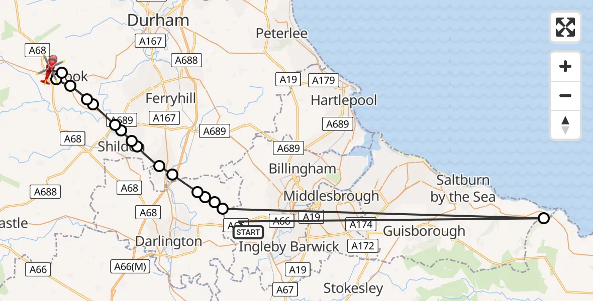
On Monday, 27 April 2026 at 16:12, a Air Ambulance Helicopter departed from Longnewton to Wolsingham. It was the Air Ambulance Helicopter with registration number G-NHAD. The flight lasted 9 minutes. During that period, the aircraft travelled 69 miles at an average speed of 478 miles per hour at a maximum altitude of 1075 feet.
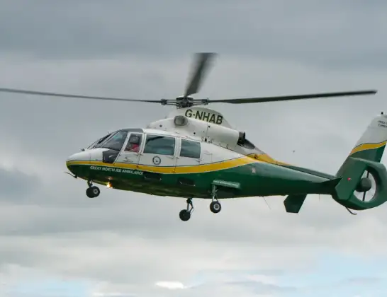
Helicopter: G-NHAD
The helicopter G-NHAD is used as a air ambulance helicopter. The main purpose of this aircraft is to transport a Mobile Medical Team to an incident as quickly as possible, enabling the trauma doctor to provide immediate first aid on site. The aircraft is flying this flight as Air Ambulance Helicopter.
Photo: Samloynes 1
70 miles
1075 feet
478 mph
9 minutes
16:12
16:20

Route
Roddymoor Road, County Durham16:20
Crook, County Durham16:20
Fir Tree, County Durham16:19
Crook, County Durham16:19
New Hunwick, County Durham16:18
Toronto, County Durham16:18
Bishop Auckland, County Durham16:17
South Church, County Durham16:17
Eldon, County Durham16:16
Shildon, County Durham16:16
Newton Aycliffe, County Durham16:15
Aycliffe Village, County Durham16:15
Brafferton, Darlington16:14
Sadberge, Darlington16:14
East and West Newbiggin, Darlington16:13
Sadberge, Darlington16:13
Staithes, North Yorkshire16:13
Darlington Road, Stockton-on-Tees16:12
Longnewton, Stockton-on-Tees16:12
Live flights
Police Helicopter on its way from East Ardsley26 Jul 22:32
Today
Air Ambulance Helicopter to Henstridge Airfield26 Jul 23:32
Police Helicopter to Glasgow26 Jul 23:19
Air Ambulance Helicopter to Norwich Airport26 Jul 23:13
Police Helicopter to MOD St Athan26 Jul 23:10
Police Helicopter to Merthyr Tydfil, A47026 Jul 23:02
Police Helicopter to Harborough, Sulby Road26 Jul 22:59
Police Helicopter to Solihull, Centro Way26 Jul 22:57
Flights Wolsingham
Air Ambulance Helicopter to Wolsingham, A68927 Jun 13:29
Flights Longnewton
Air Ambulance Helicopter to Longnewton20 Jul 12:53
Air Ambulance Helicopter to Egglescliffe19 Jul 12:30
Air Ambulance Helicopter to Longnewton, Aislaby19 Jul 09:34
Air Ambulance Helicopter to Longnewton, Aislaby18 Jul 19:12
Helicopter flights on your website?
You can easily display helicopter flights on your own website. Use the embed code.
