Police Helicopter to Burnhouse, Barrmill
Sunday, 26 April 2026 | 20:46 | From East Kilbride
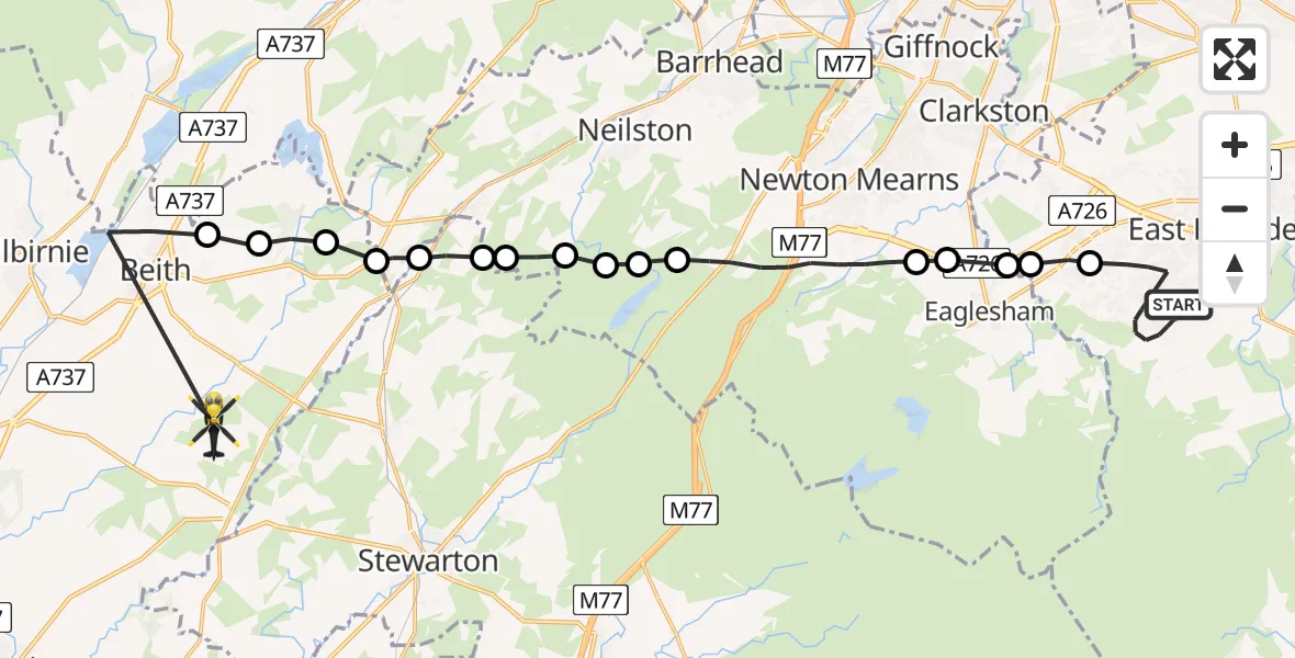
On Sunday, 26 April 2026 at 20:46, a Police Helicopter departed from East Kilbride to Burnhouse. It was the Police Helicopter with registration number G-POLS. The flight lasted 21 minutes. During that period, the aircraft travelled 24 miles at an average speed of 71 miles per hour at a maximum altitude of 1750 feet.
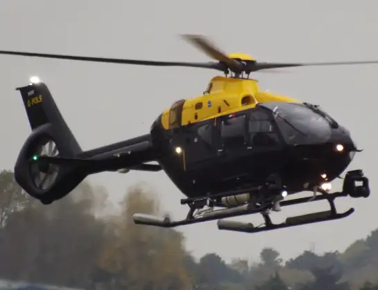
Helicopter: G-POLS
The helicopter G-POLS is used by the British police. The helicopter is deployed in pursuits, missing persons cases and other incidents where a helicopter provides added value.
Photo: James from Cheltenham, Gloucestershire
25 miles
1750 feet
71 mph
21 minutes
20:46
21:07

Route
Barrmill, North Ayrshire21:07
Beith, North Ayrshire20:57
Gateside, North Ayrshire20:57
North Ayrshire, North Ayrshire20:56
Gateside, North Ayrshire20:56
Uplawmoor, East Renfrewshire20:56
Lugton, East Ayrshire20:55
Hazelbank Farm, East Ayrshire20:55
East Renfrewshire, East Renfrewshire20:54
Nether Carswell, East Renfrewshire20:54
Moyne Moor, East Renfrewshire20:54
Neilston, East Renfrewshire20:53
Newton Mearns, East Renfrewshire20:51
Waterfoot, East Renfrewshire20:51
Eaglesham, East Renfrewshire20:50
Eaglesham, South Lanarkshire20:50
Jackton, South Lanarkshire20:50
Mulberry Way, South Lanarkshire20:46
Live flights
Today
Flights Burnhouse
Police Helicopter to Burnhouse, Barrmill17 Jun 11:24
Police Helicopter to Glasgow, Paisley Road West14 Jun 14:00
Police Helicopter to Burnhouse, Barrmill26 Apr 20:46
Police Helicopter to Burnhouse, Lochlibo Road13 Feb 18:00
Helicopter flights on your website?
You can easily display helicopter flights on your own website. Use the embed code.
