Air Ambulance Helicopter to Begbroke, Fernhill Road
Sunday, 26 April 2026 | 14:20 | From Enstone
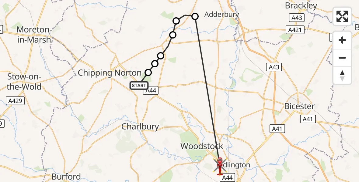
On Sunday, 26 April 2026 at 14:20, a Air Ambulance Helicopter departed from Enstone to Begbroke. It was the Air Ambulance Helicopter with registration number G-OMAA. The flight lasted 10 minutes. During that period, the aircraft travelled 22 miles at an average speed of 130 miles per hour at a maximum altitude of 2025 feet.
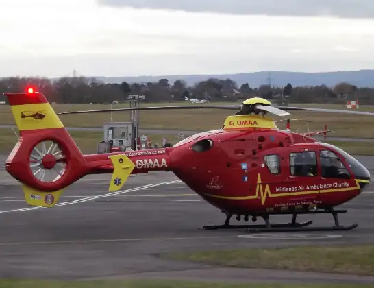
Helicopter: G-OMAA
The helicopter G-OMAA is used as a air ambulance helicopter. The main purpose of this aircraft is to transport a Mobile Medical Team to an incident as quickly as possible, enabling the trauma doctor to provide immediate first aid on site. The aircraft is flying this flight as Air Ambulance Helicopter.
Photo: James from Cheltenham, Gloucestershire
22 miles
2025 feet
130 mph
11 minutes
14:20
14:30

Route
Fernhill Road, Oxfordshire14:30
Bloxham, Oxfordshire14:23
Milcombe, Oxfordshire14:22
South Newington, Oxfordshire14:22
Great Tew, Oxfordshire14:21
Little Tew, Oxfordshire14:21
Heythrop, Oxfordshire14:20
A44, Oxfordshire14:20
Enstone, Oxfordshire14:20
Live flights
Today
Flights Begbroke
Police Helicopter to Begbroke, Spring Hill Road15 Jul 08:35
Flights Enstone
Air Ambulance Helicopter to Enstone, B40224 Apr 12:39
Helicopter flights on your website?
You can easily display helicopter flights on your own website. Use the embed code.
