Air Ambulance Helicopter to Langarth, Treliske Roundabout
Sunday, 26 April 2026 | 13:16 | From St. Stephen-in-Brannel
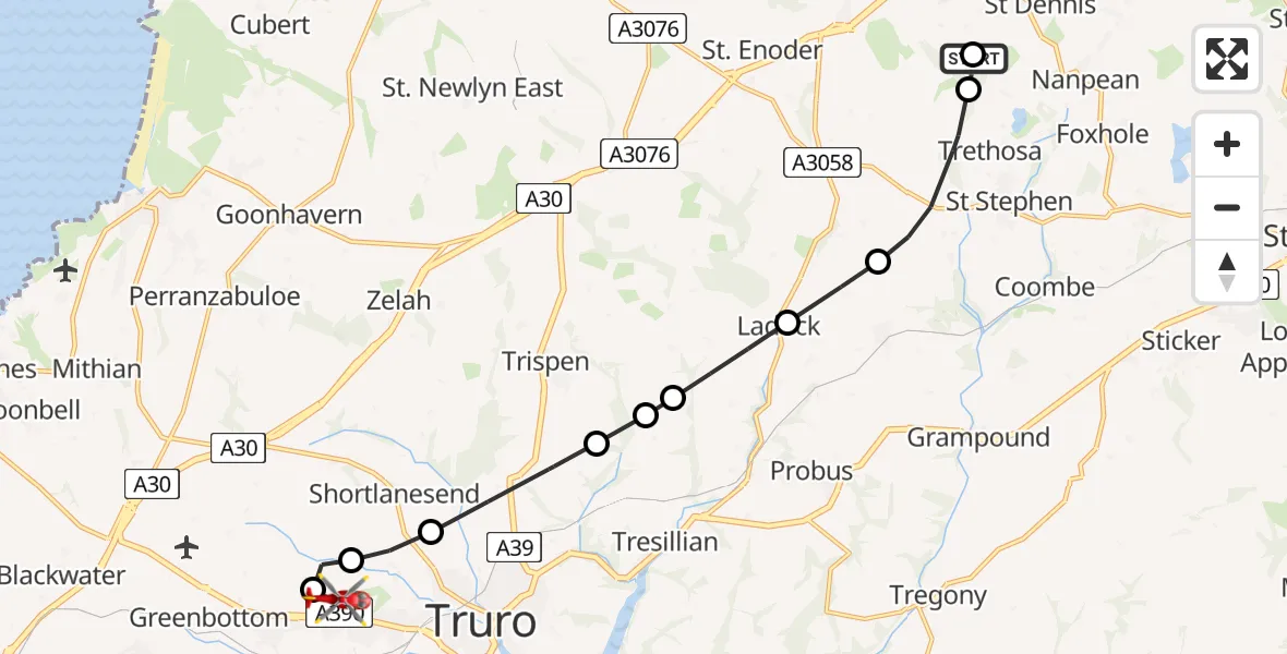
On Sunday, 26 April 2026 at 13:16, a Air Ambulance Helicopter departed from St. Stephen-in-Brannel to Langarth. It was the Air Ambulance Helicopter with registration number G-CRWL. The flight lasted 6 minutes. During that period, the aircraft travelled 12 miles at an average speed of 120 miles per hour at a maximum altitude of 850 feet.
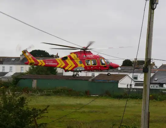
Helicopter: G-CRWL
The helicopter G-CRWL is used as a air ambulance helicopter. The main purpose of this aircraft is to transport a Mobile Medical Team to an incident as quickly as possible, enabling the trauma doctor to provide immediate first aid on site. The aircraft is flying this flight as Air Ambulance Helicopter.
Photo: Pete Cruse
13 miles
850 feet
120 mph
7 minutes
13:16
13:22

Route
Treliske Roundabout, Cornwall13:22
Langarth, Cornwall13:22
Treliske, Cornwall13:21
Truro, Cornwall13:21
St. Clement, Cornwall13:20
St. Erme, Cornwall13:19
Probus, Cornwall13:19
Ladock, Cornwall13:18
Grampound Road, Cornwall13:18
Trethosa, Cornwall13:17
St. Dennis, Cornwall13:16
St. Stephen-in-Brannel, Cornwall13:16
Live flights
Today
Flights Langarth
Helicopter flights on your website?
You can easily display helicopter flights on your own website. Use the embed code.
