Air Ambulance Helicopter to Highland
Sunday, 26 April 2026 | 4:02 | From Tornagrain
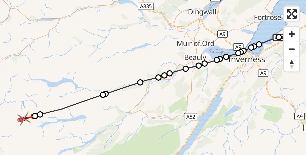
On Sunday, 26 April 2026 at 4:02, a Air Ambulance Helicopter departed from Tornagrain to Highland. It was the Air Ambulance Helicopter with registration number G-GSAS. The flight lasted 22 minutes. During that period, the aircraft travelled 45 miles at an average speed of 126 miles per hour at a maximum altitude of 4150 feet.
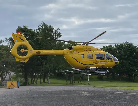
Helicopter: G-GSAS
The helicopter G-GSAS is used as a air ambulance helicopter. The main purpose of this aircraft is to transport a Mobile Medical Team to an incident as quickly as possible, enabling the trauma doctor to provide immediate first aid on site. The aircraft is flying this flight as Air Ambulance Helicopter.
Photo: Scanbus
46 miles
4150 feet
126 mph
22 minutes
04:02
04:23

Route
Highland, Highland04:23
Highland, Highland04:23
Coire Lungard, Highland04:22
Highland, Highland04:17
Memorial To Pipe Major William Collie Ross, Highland04:17
Highland, Highland04:14
Struy, Highland04:13
Highland, Highland04:12
Aigas, Highland04:12
Kilmorack, Highland04:10
Beauly, Highland04:09
Kirkhill, Highland04:08
Inchmore, Highland04:08
Inverness, Highland04:07
Inchmore, Highland04:07
Inverness, Highland04:06
North Kessock, Highland04:06
Inverness, Highland04:05
Kilmuir, Highland04:05
Inverness, Highland04:04
Kilmuir, Highland04:04
Inverness, Highland04:02
Tornagrain, Highland04:02
Live flights
Today
Coastguard Helicopter to Connel18:54:20
Flights Highland
Air Ambulance Helicopter to Highland25 Apr 23:32
Air Ambulance Helicopter to Highland24 Apr 19:47
Coastguard Helicopter to Highland24 Apr 14:36
Air Ambulance Helicopter to Highland24 Apr 12:24
Flights Tornagrain
Air Ambulance Helicopter to Loch Ness19 Apr 00:10
Air Ambulance Helicopter to Highland10 Apr 23:39
Air Ambulance Helicopter to Tornagrain, A9630 Mar 09:26
Air Ambulance Helicopter to Highland28 Mar 18:46
Air Ambulance Helicopter to Achlean, Tornagrain22 Mar 12:41
Air Ambulance Helicopter to Tornagrain, A9618 Mar 15:41
Helicopter flights on your website?
You can easily display helicopter flights on your own website. Use the embed code.
