Coastguard Helicopter to Tornagrain, Dalcross Station Road
Friday, 20 March 2026 | 12:02 | From Inverness Airport
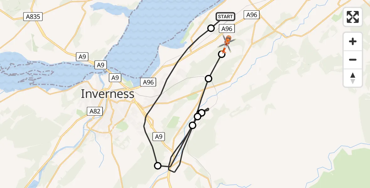
On Friday, 20 March 2026 at 12:02, a Coastguard Helicopter departed from Inverness Airport to Tornagrain. It was the Coastguard Helicopter with registration number G-MCGX. The flight lasted 31 minutes. During that period, the aircraft travelled 27 miles at an average speed of 52 miles per hour at a maximum altitude of 1100 feet.
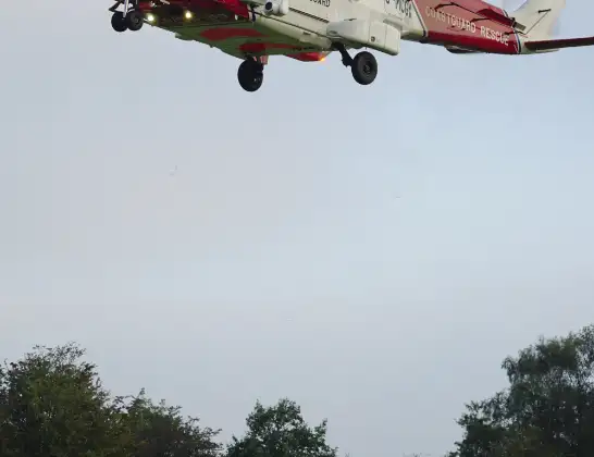
Helicopter: G-MCGX
The helicopter G-MCGX is used by the British Coastguard. The helicopter is deployed in search and rescue operations at sea, rescue operations involving ships or drilling platforms, patrols to prevent smuggling or piracy, environmental monitoring and disaster relief support.
Photo: Nick (UK)
27 miles
1100 feet
52 mph
32 minutes
12:02
12:33

Route
Tornagrain, Tornagrain12:23
Inverness, Inverness12:23
Newlands of Culloden, Newlands of Culloden12:22
Daviot, Daviot12:16
Inverness, Inverness12:15
Daviot, Daviot12:14
Inverness, Inverness12:12
Daviot, Daviot12:10
Dalcross Station Road, Inverness12:03
Inverness Airport, Inverness12:02
Today
Flights Tornagrain
Air Ambulance Aircraft to RAF Lossiemouth5 Jul 23:17
Air Ambulance Helicopter to Tornagrain19 Jun 13:24
Air Ambulance Helicopter to Tornagrain, A9611 Jun 18:42
Coastguard Helicopter to Inverness Airport10 Jun 11:37
Air Ambulance Helicopter to Tornagrain7 Jun 14:03
Air Ambulance Helicopter to Tornagrain3 Jun 20:44
Air Ambulance Helicopter to Tornagrain, A9629 May 17:18
Air Ambulance Helicopter to Tornagrain26 Apr 05:46
Helicopter flights on your website?
You can easily display helicopter flights on your own website. Use the embed code.
