Police Helicopter to Thorpe Arnold, Saxby Road
Saturday, 25 April 2026 | 15:31 | From Crowborough
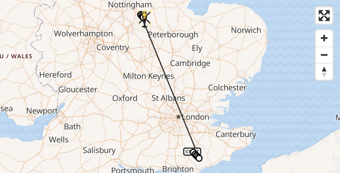
On Saturday, 25 April 2026 at 15:31, a Police Helicopter departed from Crowborough to Thorpe Arnold. It was the Police Helicopter with registration number G-POLH. The flight lasted 15 minutes. During that period, the aircraft travelled 155 miles at an average speed of 600 miles per hour at a maximum altitude of 1375 feet.
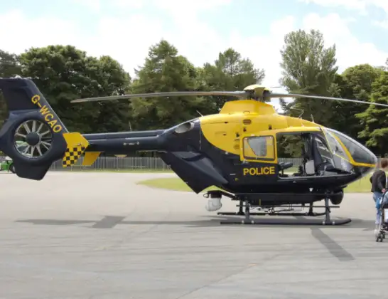
Helicopter: G-POLH
The helicopter G-POLH is used by the British police. The helicopter is deployed in pursuits, missing persons cases and other incidents where a helicopter provides added value.
Photo: Arpingstone
155 miles
1375 feet
600 mph
16 minutes
15:31
15:47

Route
Saxby Road, Leicestershire15:47
Scalford, Leicestershire15:46
Melton, Leicestershire15:46
Scalford, Leicestershire15:45
Ab Kettleby, Leicestershire15:44
Holwell, Leicestershire15:44
Punnett's Town, East Sussex15:35
Cade Street, East Sussex15:35
Broad Oak, East Sussex15:35
Heathfield, East Sussex15:34
Mayfield, East Sussex15:34
Five Ashes, East Sussex15:33
Wealden, East Sussex15:32
Eridge Road, East Sussex15:31
Live flights
Police Helicopter on its way from East Ardsley24 Jul 23:19
Police Helicopter on its way from MOD St Athan24 Jul 22:16
Today
Police Helicopter to North Weald Airfield24 Jul 22:53
Air Ambulance Helicopter to Caernarfon Airport24 Jul 22:42
Police Helicopter to Rockbeare, Westcott Road24 Jul 22:17
Police Helicopter to Almondsbury Helicopter Base24 Jul 22:17
Police Helicopter to East Ardsley, Stoney Lane24 Jul 21:51
Flights Crowborough
Air Ambulance Helicopter to Wealden, Crowborough15 Jun 20:47
Air Ambulance Helicopter to Redhill Aerodrome14 May 22:56
Air Ambulance Helicopter to Redhill Aerodrome14 May 11:57
Police Helicopter to Thorpe Arnold, Saxby Road25 Apr 15:31
Helicopter flights on your website?
You can easily display helicopter flights on your own website. Use the embed code.
