Air Ambulance Helicopter to Hury
Saturday, 25 April 2026 | 14:28 | From Longnewton
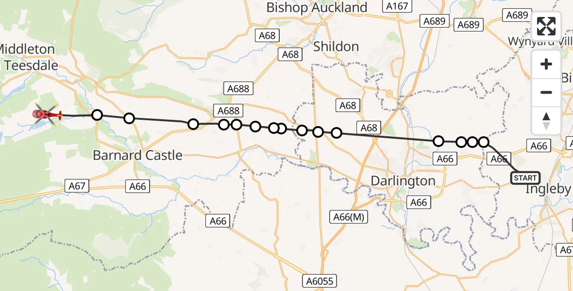
On Saturday, 25 April 2026 at 14:28, a Air Ambulance Helicopter departed from Longnewton to Hury. It was the Air Ambulance Helicopter with registration number G-NHAD. The flight lasted 11 minutes. During that period, the aircraft travelled 27 miles at an average speed of 151 miles per hour at a maximum altitude of 1525 feet.
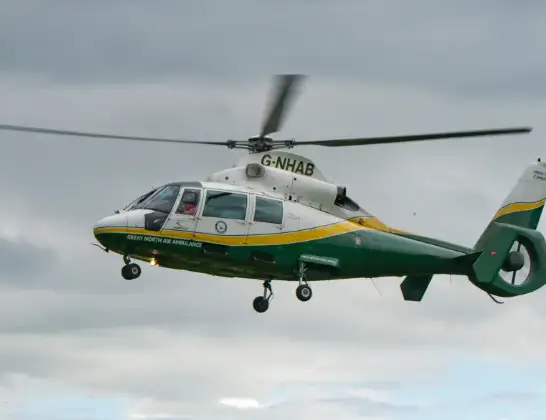
Helicopter: G-NHAD
The helicopter G-NHAD is used as a air ambulance helicopter. The main purpose of this aircraft is to transport a Mobile Medical Team to an incident as quickly as possible, enabling the trauma doctor to provide immediate first aid on site. The aircraft is flying this flight as Air Ambulance Helicopter.
Photo: Samloynes 1
28 miles
1525 feet
151 mph
11 minutes
14:28
14:39

Route
Hury, County Durham14:39
Cotherstone, County Durham14:37
Eggleston, County Durham14:37
Stainton, County Durham14:36
Cleatlam, County Durham14:35
Staindrop Private Airstrip, Darlington, Durham14:35
Staindrop, County Durham14:34
Gainford, County Durham14:34
Headlam, County Durham14:34
Killerby, Darlington14:33
Merrybent, Darlington14:33
Walworth, Darlington14:33
Barmpton, Darlington14:31
Sadberge, Darlington14:30
East and West Newbiggin, Darlington14:30
Sadberge, Darlington14:30
Longnewton Lane, Stockton-on-Tees14:28
Longnewton, Stockton-on-Tees14:28
Today
Flights Hury
Air Ambulance Helicopter to Hury25 Apr 14:28
Flights Longnewton
Air Ambulance Helicopter to Longnewton20 Jul 12:53
Air Ambulance Helicopter to Egglescliffe19 Jul 12:30
Air Ambulance Helicopter to Longnewton, Aislaby19 Jul 09:34
Air Ambulance Helicopter to Longnewton, Aislaby18 Jul 19:12
Helicopter flights on your website?
You can easily display helicopter flights on your own website. Use the embed code.
