Air Ambulance Aircraft to Linwood, Barnsford Road
Saturday, 25 April 2026 | 11:13 | From Lagavulin
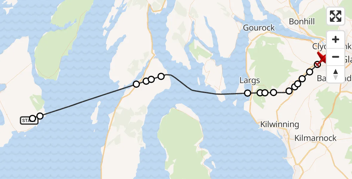
On Saturday, 25 April 2026 at 11:13, a Air Ambulance Aircraft departed from Lagavulin to Linwood. It was the Air Ambulance Aircraft with registration number G-SASD. The flight lasted 18 minutes. During that period, the aircraft travelled 70 miles at an average speed of 231 miles per hour at a maximum altitude of 7000 feet.
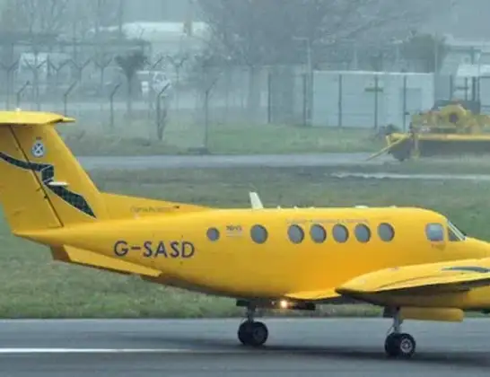
Helicopter: G-SASD
The aircraft G-SASD is used as an air ambulance aircraft. The main purpose of this aircraft is to transport a Mobile Medical Team to an incident as quickly as possible, enabling the trauma doctor to provide immediate first aid on site. The aircraft is flying this flight as Air Ambulance Aircraft.
Photo: Albert Bridge
71 miles
7000 feet
231 mph
19 minutes
11:13
11:32

Route
Barnsford Road, Renfrewshire11:32
Linwood, Renfrewshire11:31
Johnstone, Renfrewshire11:30
Howwood, Renfrewshire11:29
Newton of Belltrees, Renfrewshire11:29
Auchengrange, Renfrewshire11:28
Beith, North Ayrshire11:28
Kilbirnie, North Ayrshire11:27
Routdaneburn, North Ayrshire11:26
Avro-Anson crash site, North Ayrshire11:26
Fairlie, North Ayrshire11:25
Inner Seas11:21
Argyll and Bute, Argyll and Bute11:20
Kennacraig, Argyll and Bute11:20
Clachan, Argyll and Bute11:19
Inner Seas11:14
Argyll and Bute, Argyll and Bute11:14
Lagavulin, Argyll and Bute11:13
Live flights
Today
Flights Linwood
Air Ambulance Aircraft to Linwood, M89 May 19:07
Air Ambulance Aircraft to Linwood, M830 Apr 13:54
Air Ambulance Aircraft to Linwood, M828 Apr 13:19
Air Ambulance Aircraft to Linwood, M810 Feb 09:12
Air Ambulance Aircraft to Linwood, Candren Road31 Jan 22:30
Air Ambulance Aircraft to Linwood, Candren Road17 Jan 14:28
Flights Lagavulin
Air Ambulance Aircraft to Glasgow Airport13 Apr 22:03
Air Ambulance Aircraft to Glasgow Airport12 Jan 22:51
Helicopter flights on your website?
You can easily display helicopter flights on your own website. Use the embed code.
