Police Helicopter to Aigburth, Riversdale Road
Friday, 24 April 2026 | 14:51 | From Hawarden Airport
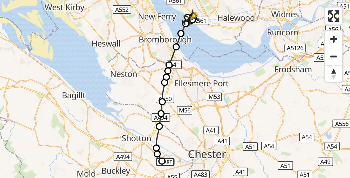
On Friday, 24 April 2026 at 14:51, a Police Helicopter departed from Hawarden Airport to Aigburth. It was the Police Helicopter with registration number G-POLG. The flight lasted 11 minutes. During that period, the aircraft travelled 17 miles at an average speed of 91 miles per hour at a maximum altitude of 700 feet.
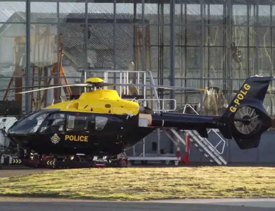
Helicopter: G-POLG
The helicopter G-POLG is used by the British police. The helicopter is deployed in pursuits, missing persons cases and other incidents where a helicopter provides added value.
Photo: James from Cheltenham, Gloucestershire
18 miles
700 feet
91 mph
12 minutes
14:51
15:02

Route
Riversdale Road, Merseyside - Liverpool15:02
Aigburth, Liverpool15:00
Grassendale, Liverpool14:59
Aigburth, Liverpool14:58
Grassendale, Liverpool14:58
Aigburth, Liverpool14:57
Liverpool, Liverpool City Region14:57
Eastham Village, Wirral14:57
Bromborough, Wirral14:56
Eastham Village, Wirral14:55
Willaston, Cheshire West and Chester14:55
Chester, Cheshire West and Chester14:55
Ellesmere Port, Cheshire West and Chester14:55
Chester, Cheshire West and Chester14:54
Shotwick, Cheshire West and Chester14:54
Shotton, Flintshire14:53
Sealand, Flintshire14:52
Sandycroft, Flintshire14:52
Chester Road, Flintshire14:52
Broughton, Flintshire14:51
Hawarden Airport, Broughton14:51
Live flights
Today
Flights Aigburth
Police Helicopter to Aigburth, Riversdale Road24 Apr 15:36
Police Helicopter to Aigburth, Riversdale Road24 Apr 14:51
Helicopter flights on your website?
You can easily display helicopter flights on your own website. Use the embed code.
