Air Ambulance Helicopter to Haverfordwest, Fishguard Road
Friday, 24 April 2026 | 5:49 | From Pembroke Dock
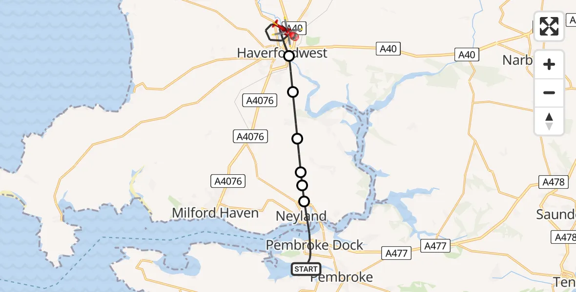
On Friday, 24 April 2026 at 5:49, a Air Ambulance Helicopter departed from Pembroke Dock to Haverfordwest. It was the Air Ambulance Helicopter with registration number G-WROL. The flight lasted 7 minutes. During that period, the aircraft travelled 12 miles at an average speed of 114 miles per hour at a maximum altitude of 675 feet.
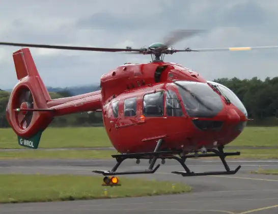
Helicopter: G-WROL
The helicopter G-WROL is used as a air ambulance helicopter. The main purpose of this aircraft is to transport a Mobile Medical Team to an incident as quickly as possible, enabling the trauma doctor to provide immediate first aid on site. The aircraft is flying this flight as Air Ambulance Helicopter.
Photo: James from Cheltenham, Gloucestershire
13 miles
675 feet
114 mph
7 minutes
05:49
05:55

Route
Fishguard Road, Pembrokeshire05:55
Haverfordwest, Pembrokeshire05:52
Merlin's Bridge, Pembrokeshire05:52
Freystrop Cross, Pembrokeshire05:51
Rosemarket, Pembrokeshire05:50
Burton, Pembrokeshire05:50
Neyland, Pembrokeshire05:50
Fleet Street, Pembrokeshire05:49
Live flights
Today
Police Helicopter to Treuddyn14:32:24
Police Helicopter to Dunblane14:13:32
Flights Haverfordwest
Air Ambulance Helicopter to Dafen, Heol Aur9 Jul 17:40
Coastguard Helicopter to Tenby, Heywood Lane28 May 17:41
Air Ambulance Helicopter to Saron, Saron Road25 May 11:38
Air Ambulance Helicopter to Cardiff Heliport24 Apr 06:52
Helicopter flights on your website?
You can easily display helicopter flights on your own website. Use the embed code.
