Air Ambulance Helicopter to Cwrt, A493
Thursday, 23 April 2026 | 22:13 | From Ceri
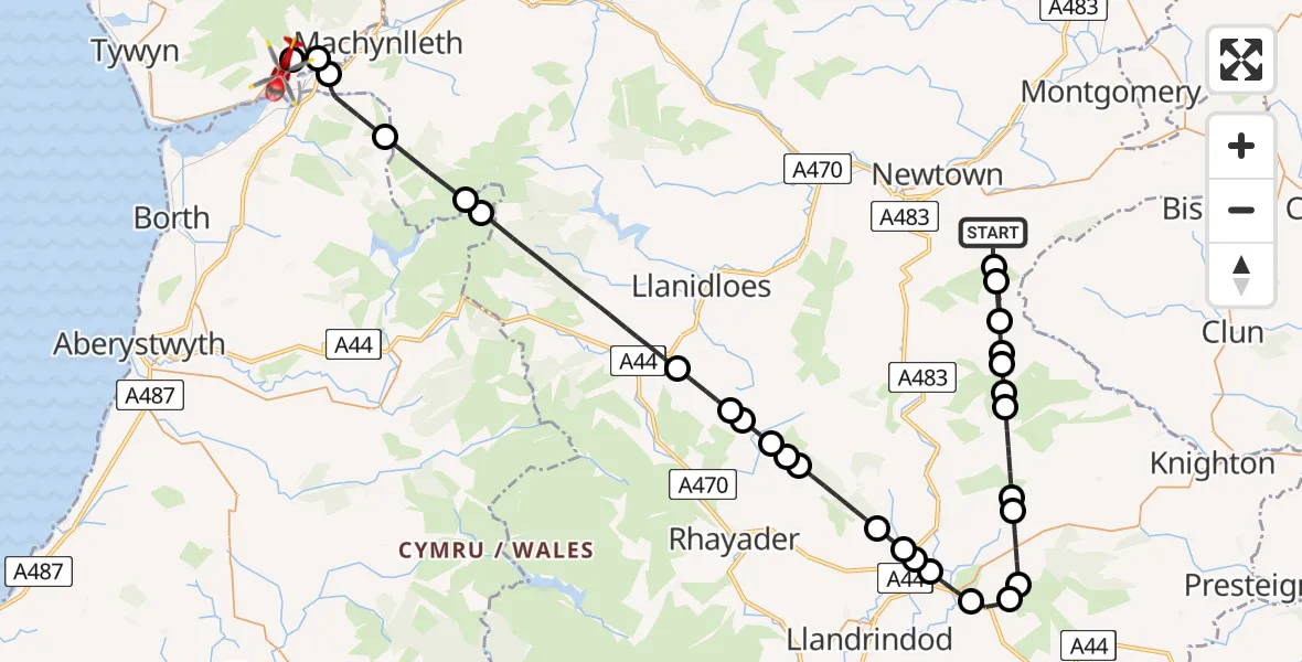
On Thursday, 23 April 2026 at 22:13, a Air Ambulance Helicopter departed from Ceri to Cwrt. It was the Air Ambulance Helicopter with registration number G-WROL. The flight lasted 26 minutes. During that period, the aircraft travelled 57 miles at an average speed of 135 miles per hour at a maximum altitude of 2900 feet.
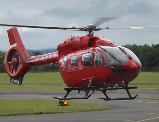
Helicopter: G-WROL
The helicopter G-WROL is used as a air ambulance helicopter. The main purpose of this aircraft is to transport a Mobile Medical Team to an incident as quickly as possible, enabling the trauma doctor to provide immediate first aid on site. The aircraft is flying this flight as Air Ambulance Helicopter.
Photo: James from Cheltenham, Gloucestershire
58 miles
2900 feet
135 mph
26 minutes
22:13
22:38

Route
A493, Gwynedd22:38
Cwrt, Gwynedd22:38
Pennal, Gwynedd22:37
Machynlleth, Powys22:37
Ysgubor-y-coed, Ceredigion22:35
Cadfarch, Powys22:33
Blaenrheidol, Ceredigion22:33
Llangurig, Powys22:29
St. Harmon, Powys22:28
Pant-y-dŵr, Powys22:28
St Harmon, Powys22:28
St. Harmon, Powys22:27
Bwlch-y-Sarnau, Powys22:27
Abbey Cwmhir, Powys22:26
Llanddewi Ystradenny, Powys22:25
Llanddewi Ystradenni, Powys22:25
Crossgates, Powys22:25
Penybont, Powys22:24
Llandegley, Powys22:23
Penybont, Powys22:23
Llanfihangel Rhydieithon, Powys22:21
Llanddewi Ystradenny, Powys22:21
Llanbister, Powys22:19
Felindre, Powys22:19
Beguildy, Powys22:19
Felindre, Powys22:18
Beguildy, Powys22:18
Dolfor, Powys22:18
Beguildy, Powys22:17
Ceri, Powys22:14
Ceri, Powys22:13
Live flights
Today
Flights Cwrt
Air Ambulance Helicopter to Cwrt, A49323 Apr 22:13
Coastguard Helicopter to Caernarfon Airport10 Jan 17:23
Flights Ceri
Air Ambulance Helicopter to Rhyl, Rhuddlan Road21 Jun 22:41
Air Ambulance Helicopter to Ceri, Fairfield21 Jun 20:44
Air Ambulance Helicopter to Ceri, Oak Drive9 May 15:51
Air Ambulance Helicopter to Cwrt, A49323 Apr 22:13
Air Ambulance Helicopter to Ceri23 Apr 21:11
Air Ambulance Helicopter to Ceri23 Apr 20:35
Helicopter flights on your website?
You can easily display helicopter flights on your own website. Use the embed code.
