Police Helicopter to Uphill, Uphill Road South
Wednesday, 22 April 2026 | 16:54 | From MOD St Athan
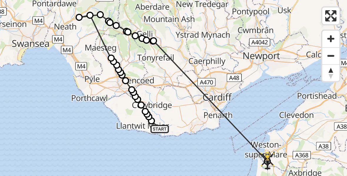
On Wednesday, 22 April 2026 at 16:54, a Police Helicopter departed from MOD St Athan to Uphill. It was the Police Helicopter with registration number G-NWOI. The flight lasted 29 minutes. During that period, the aircraft travelled 71 miles at an average speed of 149 miles per hour at a maximum altitude of 2350 feet.
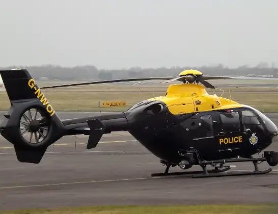
Helicopter: G-NWOI
The helicopter G-NWOI is used by the British police. The helicopter is deployed in pursuits, missing persons cases and other incidents where a helicopter provides added value.
Photo: James from Cheltenham
71 miles
2350 feet
149 mph
29 minutes
16:54
17:23

Route
Uphill Road South, North Somerset17:23
Uphill, North Somerset17:21
Pontygwaith, Rhondda Cynon Taf17:13
Tonypandy, Rhondda Cynon Taf17:13
Clydach Vale, Rhondda Cynon Taf17:12
Gelli, Rhondda Cynon Taf17:12
Pentre, Rhondda Cynon Taf17:11
Cwm Parc, Rhondda Cynon Taf17:10
Abergwynfi, Bridgend17:10
Blaengwynfi, Neath Port Talbot17:09
Cymer and Glyncorrwg, Neath Port Talbot17:08
Glyncorrwg, Neath Port Talbot17:08
Resolven, Neath Port Talbot17:07
Tonna, Neath Port Talbot17:04
Abergarwed, Neath Port Talbot17:03
Llangynwyd, Bridgend17:00
Coytrahen, Bridgend17:00
Bettws, Bridgend16:59
Tondu, Bridgend16:59
Brynmenyn, Bridgend16:59
Bryncethin, Bridgend16:59
Coity, Bridgend16:58
Coychurch, Bridgend16:58
Treoes, Vale of Glamorgan16:57
Llangan, Vale of Glamorgan16:57
Colwinston, Vale of Glamorgan16:57
Llysworney, Vale of Glamorgan16:56
Sigingstone, Vale of Glamorgan16:56
Cowbridge, Vale of Glamorgan16:56
Sigingstone, Vale of Glamorgan16:55
St Mary Church, Vale of Glamorgan16:55
MOD St Athan, St Athan, Vale of Glamorgan16:54
Live flights
Today
Flights Uphill
Police Helicopter to Uphill, Brockley Crescent26 Apr 15:22
Police Helicopter to Uphill, Uphill Road South22 Apr 17:31
Police Helicopter to Uphill, Uphill Road South22 Apr 16:54
Police Helicopter to Uphill, Beechmount Close10 Mar 11:20
Police Helicopter to Uphill, Oldmixon Crescent28 Feb 17:43
Helicopter flights on your website?
You can easily display helicopter flights on your own website. Use the embed code.
