Police Helicopter to Chittlehamholt, B3226
Tuesday, 21 April 2026 | 20:26 | From Exeter International Airport
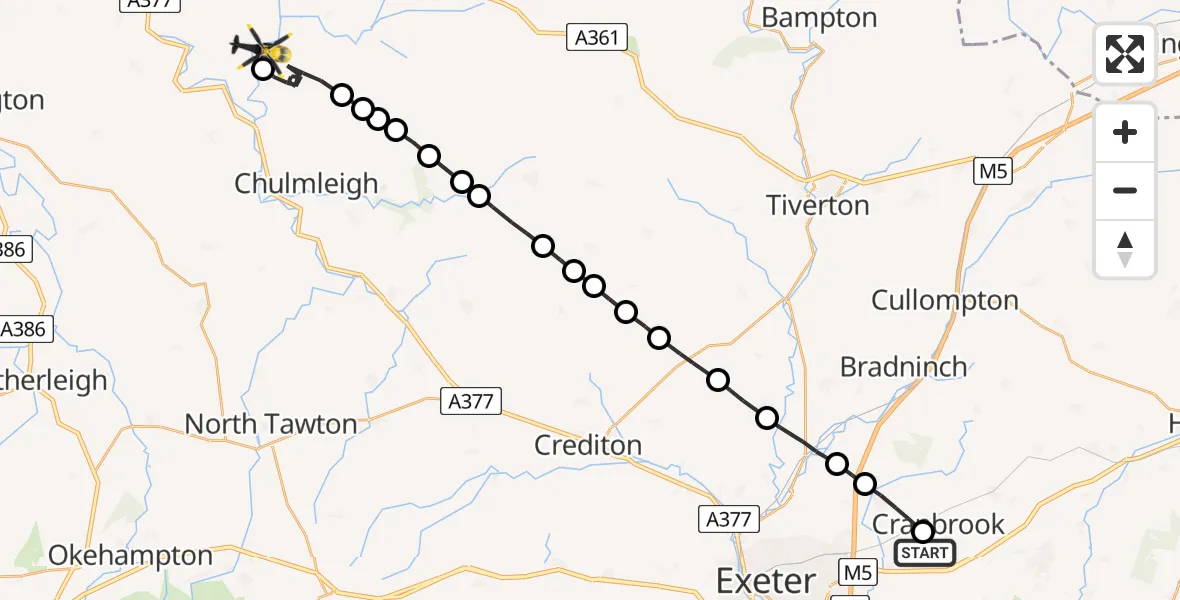
On Tuesday, 21 April 2026 at 20:26, a Police Helicopter departed from Exeter International Airport to Chittlehamholt. It was the Police Helicopter with registration number G-CPAS. The flight lasted 16 minutes. During that period, the aircraft travelled 30 miles at an average speed of 117 miles per hour at a maximum altitude of 1325 feet.
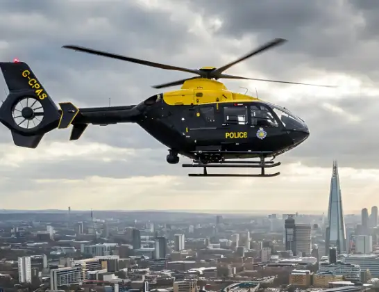
Helicopter: G-CPAS
The helicopter G-CPAS is used by the British police. The helicopter is deployed in pursuits, missing persons cases and other incidents where a helicopter provides added value.
Photo: Tony Melony
31 miles
1325 feet
117 mph
16 minutes
20:26
20:42

Route
B3226, Devon20:42
Chittlehamholt, Devon20:41
Kings Nympton, Devon20:35
North Devon, Devon20:35
Chulmleigh, Devon20:35
Romansleigh, Devon20:34
East Worlington, Devon20:34
West Worlington, Devon20:33
East Worlington, Devon20:33
Mid Devon, Devon20:32
Puddington, Devon20:32
Kennerleigh, Devon20:31
Poughill, Devon20:31
Cheriton Fitzpaine, Devon20:30
Stockleigh Pomeroy, Devon20:30
Thorverton, Devon20:29
Rewe, Devon20:28
Poltimore, Devon20:27
Broadclyst, Devon20:26
Treasbeare Lane, Devon20:26
Live flights
Today
Police Helicopter to Glasgow16:00:37
Flights Chittlehamholt
Police Helicopter to Chittlehamholt, B322621 Apr 20:26
Air Ambulance Helicopter to Chittlehamholt17 Feb 09:06
Helicopter flights on your website?
You can easily display helicopter flights on your own website. Use the embed code.
