Air Ambulance Helicopter to Coniston, B5285
Sunday, 19 April 2026 | 18:34 | From Edenhall
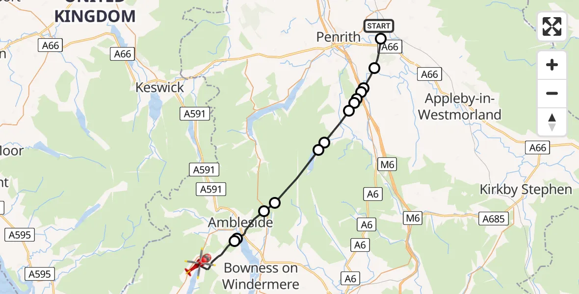
On Sunday, 19 April 2026 at 18:34, a Air Ambulance Helicopter departed from Edenhall to Coniston. It was the Air Ambulance Helicopter with registration number G-NHAE. The flight lasted 11 minutes. During that period, the aircraft travelled 28 miles at an average speed of 152 miles per hour at a maximum altitude of 2700 feet.
Helicopter: G-NHAE
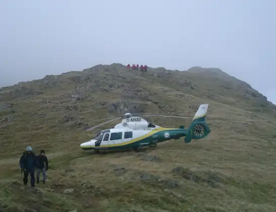
The helicopter G-NHAE is used as a air ambulance helicopter. The main purpose of this aircraft is to transport a Mobile Medical Team to an incident as quickly as possible, enabling the trauma doctor to provide immediate first aid on site. The aircraft is flying this flight as Air Ambulance Helicopter.
Photo: Michael Earnshaw
28 miles
2700 feet
152 mph
11 minutes
18:34
18:45

Route
B5285, Westmorland and Furness18:45
Hawkshead, Westmorland and Furness18:43
Windermere18:43
Ambleside, Westmorland and Furness18:42
Lakes, Westmorland and Furness18:41
Shap Rural, Westmorland and Furness18:39
Haweswater Reservoir18:39
Bampton Grange, Westmorland and Furness18:37
Lowther, Westmorland and Furness18:37
Newtown, Westmorland and Furness18:37
Hackthorpe, Westmorland and Furness18:37
Great Strickland, Westmorland and Furness18:36
Melkinthorpe, Westmorland and Furness18:36
Brougham, Westmorland and Furness18:35
Ladies Walk, Westmorland and Furness18:34
Live flights
Police Helicopter on its way from Glasgow19 Apr 23:04
Today
Police Helicopter to Thornliebank, Robslee Road19 Apr 22:48
Air Ambulance Helicopter to Cardiff Heliport19 Apr 22:25
Police Helicopter to Wrenthorpe, Stoney Lane19 Apr 22:21
Police Helicopter to Redhill Aerodrome19 Apr 22:15
Flights Coniston
Air Ambulance Helicopter to Coniston, B528519 Apr 18:34
Flights Edenhall
Air Ambulance Helicopter to Coniston, B528519 Apr 18:34
Air Ambulance Helicopter to Culgaith, B641218 Apr 09:57
Air Ambulance Helicopter to Kendal, Castle Drive16 Apr 16:45
Air Ambulance Helicopter to Edenhall14 Apr 19:55
Air Ambulance Helicopter to Kirkby Ireleth14 Apr 19:10
Air Ambulance Helicopter to Edenhall, The Avenue11 Apr 14:55
Helicopter flights on your website?
You can easily display helicopter flights on your own website. Use the embed code.
