Air Ambulance Helicopter to Uttlesford, Thaxted Road
Sunday, 19 April 2026 | 18:20 | From North Weald Airfield
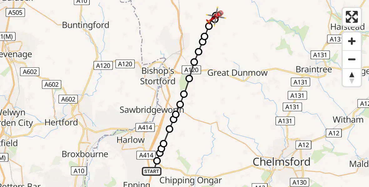
On Sunday, 19 April 2026 at 18:20, a Air Ambulance Helicopter departed from North Weald Airfield to Uttlesford. It was the Air Ambulance Helicopter with registration number G-HHEM. The flight lasted 12 minutes. During that period, the aircraft travelled 19 miles at an average speed of 97 miles per hour at a maximum altitude of 900 feet.
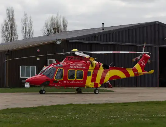
Helicopter: G-HHEM
The helicopter G-HHEM is used as a air ambulance helicopter. The main purpose of this aircraft is to transport a Mobile Medical Team to an incident as quickly as possible, enabling the trauma doctor to provide immediate first aid on site. The aircraft is flying this flight as Air Ambulance Helicopter.
Photo: Ronnie Macdonald
20 miles
900 feet
97 mph
12 minutes
18:20
18:32

Route
Thaxted Road, Essex18:32
Uttlesford, Essex18:32
Thaxted, Essex18:31
Uttlesford, Essex18:31
Chickney, Essex18:30
Broxted, Essex18:30
Molehill Green, Essex18:29
London Stansted Airport, London18:29
Takeley Street, Essex18:28
Uttlesford, Essex18:27
Hatfield Broad Oak, Essex18:27
Hatfield Heath, Essex18:26
Uttlesford, Essex18:26
Sheering, Essex18:26
Threshers Bush, Essex18:25
Magdalen Laver, Essex18:25
Threshers Bush, Essex18:24
North Weald Bassett, Essex18:24
North Weald Airfield, Epping, Essex18:24
North Weald Airfield, Epping, Essex18:20
Live flights
Today
Police Helicopter to Glasgow12:52:02
Flights Uttlesford
Police Helicopter to North Weald Airfield30 May 16:19
Air Ambulance Helicopter to Broomfield Hospital29 Apr 13:33
Police Helicopter to Uttlesford28 Mar 04:50
Police Helicopter to Lindsell, Lindsell Lane14 Jan 16:34
Police Helicopter to Magdalen Laver, Pole Lane14 Jan 15:22
Helicopter flights on your website?
You can easily display helicopter flights on your own website. Use the embed code.
