Air Ambulance Helicopter to Aintree University Hospital Heliport
Sunday, 19 April 2026 | 18:04 | From Runcorn
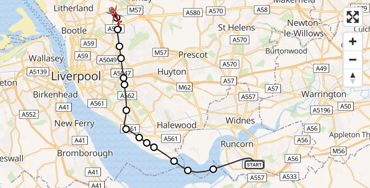
On Sunday, 19 April 2026 at 18:04, a Air Ambulance Helicopter departed from Runcorn to Aintree University Hospital Heliport. It was the Air Ambulance Helicopter with registration number G-NWEM. The flight lasted 10 minutes. During that period, the aircraft travelled 17 miles at an average speed of 104 miles per hour at a maximum altitude of 600 feet.
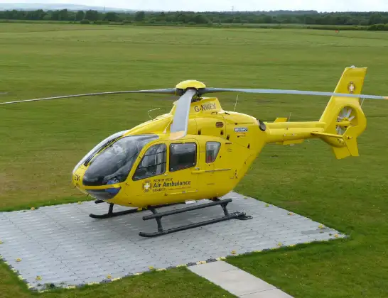
Helicopter: G-NWEM
The helicopter G-NWEM is used as a air ambulance helicopter. The main purpose of this aircraft is to transport a Mobile Medical Team to an incident as quickly as possible, enabling the trauma doctor to provide immediate first aid on site. The aircraft is flying this flight as Air Ambulance Helicopter.
Photo: Craig Sunter
18 miles
600 feet
104 mph
11 minutes
18:04
18:14

Route
Aintree University Hospital Heliport, 18:14
Aintree University Hospital Heliport18:14
Fazakerley, Liverpool18:13
Norris Green, Liverpool18:12
Stoneycroft, Liverpool18:12
Old Swan, Liverpool18:11
Broad Green, Liverpool18:11
Allerton, Liverpool18:10
Grassendale, Liverpool18:09
Garston, Liverpool18:09
Speke Airport, Liverpool18:08
Speke, Liverpool18:08
Liverpool John Lennon Airport, Liverpool18:07
Ellesmere Port, Cheshire West and Chester18:07
Hale, Halton18:06
Central Expressway, Halton18:04
Live flights
Today
Police Helicopter to Crickadarn01:28:18
Flights Runcorn
Police Helicopter to Hawarden Airport23 May 15:12
Police Helicopter to Runcorn, St Paul's Close23 May 15:01
Police Helicopter to Widnes, Mersey Gateway2 May 20:21
Helicopter flights on your website?
You can easily display helicopter flights on your own website. Use the embed code.
