Air Ambulance Helicopter to Llandderfel, A494
Sunday, 19 April 2026 | 13:16 | From Welshpool Airport
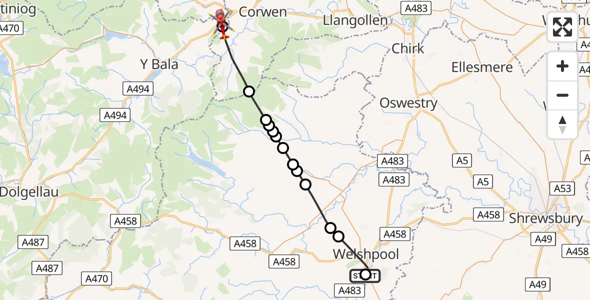
On Sunday, 19 April 2026 at 13:16, a Air Ambulance Helicopter departed from Welshpool Airport to Llandderfel. It was the Air Ambulance Helicopter with registration number G-WOBR. The flight lasted 14 minutes. During that period, the aircraft travelled 27 miles at an average speed of 117 miles per hour at a maximum altitude of 2600 feet.

Helicopter: G-WOBR
The helicopter G-WOBR is used as a air ambulance helicopter. The main purpose of this aircraft is to transport a Mobile Medical Team to an incident as quickly as possible, enabling the trauma doctor to provide immediate first aid on site. The aircraft is flying this flight as Air Ambulance Helicopter.
Photo: Hefin Owen
27 miles
2600 feet
117 mph
14 minutes
13:16
13:30

Route
A494, Gwynedd13:30
Llandderfel, Gwynedd13:29
Llandrillo, Denbighshire13:27
Llanrhaeadr-ym-Mochnant, Powys13:26
Llanrhaeadr-ym-Mochnant, Powys13:25
Pen-y-Bont-Fawr, Powys13:25
Pen-y-bont-fawr, Powys13:25
Pen-y-bont-fawr, Powys13:25
Llanrhaeadr-ym-Mochnant, Powys13:24
B4391, Powys13:24
Llanfyllin, Powys13:23
Llanfihangel yng Ngwynfa, Powys13:23
Llanfyllin, Powys13:22
Ffordd Glyndŵr, Powys13:20
Meifod, Powys13:20
Meifod, Powys13:20
Groes-lwyd, Powys13:19
A483, Powys13:18
Welshpool, Powys13:17
Welshpool Airport, Welshpool, Powys13:16
Live flights
Today
Flights Llandderfel
Air Ambulance Helicopter to Llandderfel, B450129 May 13:13
Air Ambulance Helicopter to Llandderfel, B439126 May 12:49
Air Ambulance Helicopter to Llandderfel, A49419 Apr 13:16
Police Helicopter to Llandderfel21 Mar 20:05
Helicopter flights on your website?
You can easily display helicopter flights on your own website. Use the embed code.
