Air Ambulance Helicopter to Starcross, Staplake Road
Sunday, 19 April 2026 | 10:17 | From Exeter International Airport
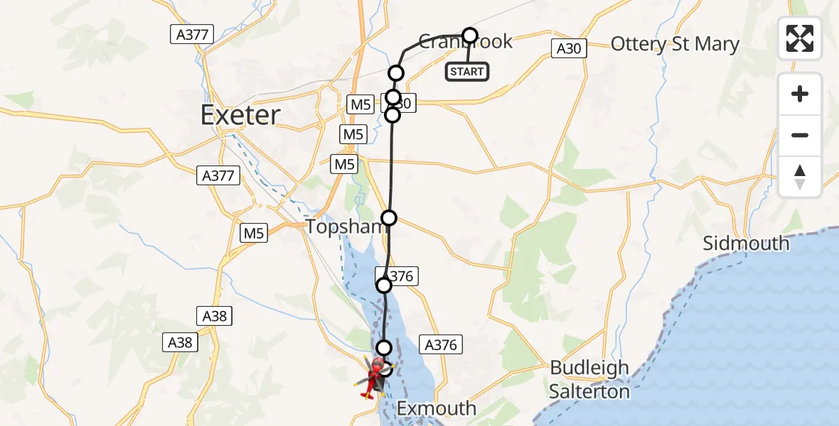
On Sunday, 19 April 2026 at 10:17, a Air Ambulance Helicopter departed from Exeter International Airport to Starcross. It was the Air Ambulance Helicopter with registration number G-DAAN. The flight lasted 11 minutes. During that period, the aircraft travelled 15 miles at an average speed of 83 miles per hour at a maximum altitude of 625 feet.

Helicopter: G-DAAN
The helicopter G-DAAN is used as a air ambulance helicopter. The main purpose of this aircraft is to transport a Mobile Medical Team to an incident as quickly as possible, enabling the trauma doctor to provide immediate first aid on site. The aircraft is flying this flight as Air Ambulance Helicopter.
Photo: Tim Felce (Airwolfhound)
15 miles
625 feet
83 mph
11 minutes
10:17
10:27

Route
Staplake Road, Devon10:27
Starcross, Devon10:21
Kenton, Devon10:21
Exton, Devon10:21
Clyst St. George, Devon10:20
Clyst St Mary, Devon10:19
Exeter, Devon10:18
West Clyst, Devon10:18
Cranbrook, Devon10:17
Parsons Lane, Devon10:17
Live flights
Today
Flights Starcross
Air Ambulance Helicopter to Starcross19 Apr 10:27
Helicopter flights on your website?
You can easily display helicopter flights on your own website. Use the embed code.
