Police Helicopter to Hascombe, Godalming Road
Sunday, 19 April 2026 | 9:40 | From South Nutfield
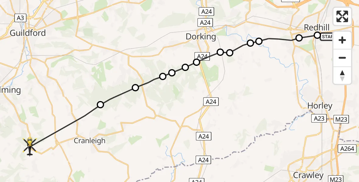
On Sunday, 19 April 2026 at 9:40, a Police Helicopter departed from South Nutfield to Hascombe. It was the Police Helicopter with registration number G-POLH. The flight lasted 8 minutes. During that period, the aircraft travelled 20 miles at an average speed of 147 miles per hour at a maximum altitude of 900 feet.
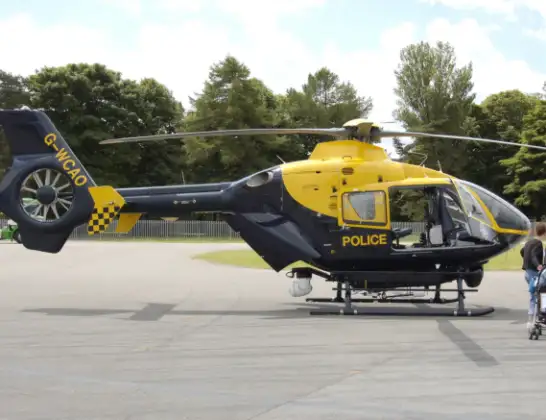
Helicopter: G-POLH
The helicopter G-POLH is used by the British police. The helicopter is deployed in pursuits, missing persons cases and other incidents where a helicopter provides added value.
Photo: Arpingstone
20 miles
900 feet
147 mph
9 minutes
09:40
09:48

Route
Godalming Road, Surrey09:48
Cranleigh, Surrey09:46
Guildford, Surrey09:45
Abinger, Surrey09:44
Mole Valley, Surrey09:44
Westcott, Surrey09:43
Dorking, Surrey09:43
North Holmwood, Surrey09:42
Brockham, Surrey09:42
Betchworth, Surrey09:42
Reigate and Banstead, Surrey09:41
Reigate, Surrey09:40
Redhill, Surrey09:40
Philanthropic Road, Surrey09:40
Live flights
Today
Police Helicopter to Irlam, M6203:28:05
Police Helicopter to Solihull, A4520 Jul 23:50
Flights Hascombe
Police Helicopter to Chiddingfold, Combe Lane19 Apr 09:48
Police Helicopter to Hascombe, Godalming Road19 Apr 09:40
Helicopter flights on your website?
You can easily display helicopter flights on your own website. Use the embed code.
