Police Helicopter to Tandridge, Crab Hill Lane
Saturday, 18 April 2026 | 20:39 | From Rochester
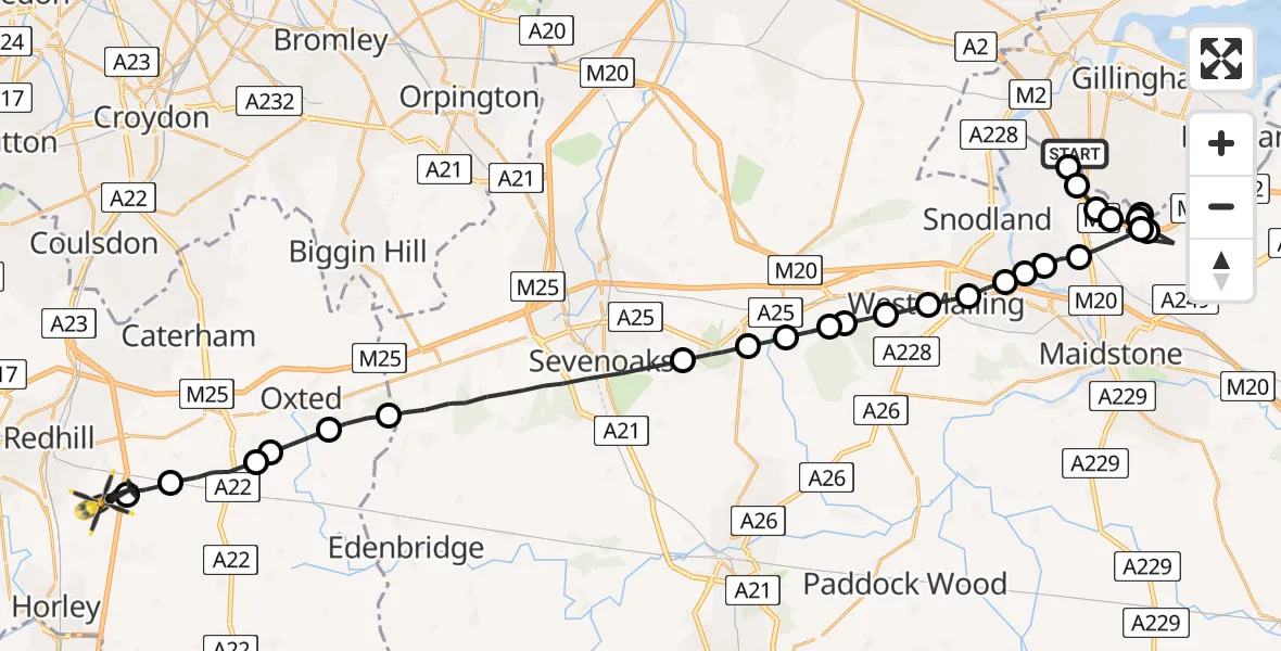
On Saturday, 18 April 2026 at 20:39, a Police Helicopter departed from Rochester to Tandridge. It was the Police Helicopter with registration number G-POLH. The flight lasted 21 minutes. During that period, the aircraft travelled 41 miles at an average speed of 118 miles per hour at a maximum altitude of 1400 feet.
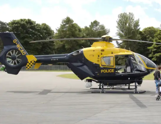
Helicopter: G-POLH
The helicopter G-POLH is used by the British police. The helicopter is deployed in pursuits, missing persons cases and other incidents where a helicopter provides added value.
Photo: Arpingstone
42 miles
1400 feet
118 mph
22 minutes
20:39
21:00

Route
Crab Hill Lane, Surrey21:00
South Nutfield, Surrey20:59
Tandridge, Surrey20:58
South Godstone, Surrey20:57
Broadham Green, Surrey20:57
Oxted, Surrey20:56
Tandridge, Surrey20:55
Sevenoaks, Kent20:51
Ightham, Kent20:51
Borough Green, Kent20:50
St Mary's Platt, Kent20:50
Mereworth, Kent20:49
Offham, Kent20:49
West Malling, Kent20:48
East Malling, Kent20:48
Ditton, Kent20:47
Aylesford, Kent20:47
Eccles, Kent20:47
Aylesford, Kent20:46
Maidstone, Kent20:45
Chatham, Kent20:44
Maidstone, Kent20:44
Chatham, Kent20:43
Maidstone, Kent20:40
Bluebell Hill, Kent20:39
Chatham, Kent20:39
Chatham, Medway20:39
Laker Road, Medway20:39
Live flights
Today
Flights Tandridge
Police Helicopter to Salfords, Cross Oak Lane31 May 19:55
Police Helicopter to Tandridge, Crab Hill Lane30 May 18:40
Police Helicopter to Tandridge, Crab Hill Lane29 May 16:24
Police Helicopter to Tandridge, Moats Lane29 May 15:09
Flights Rochester
Police Helicopter to Tandridge, Crab Hill Lane18 Apr 20:39
Helicopter flights on your website?
You can easily display helicopter flights on your own website. Use the embed code.
