Police Helicopter to Mayhill, Gwynedd Gardens
Friday, 17 April 2026 | 23:47 | From Bristol Channel
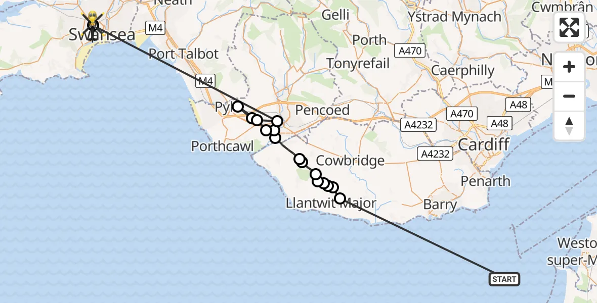
On Friday, 17 April 2026 at 23:47, a Police Helicopter departed from Bristol Channel to Mayhill. It was the Police Helicopter with registration number G-NWOI. The flight lasted 15 minutes. During that period, the aircraft travelled 50 miles at an average speed of 208 miles per hour at a maximum altitude of 1125 feet.
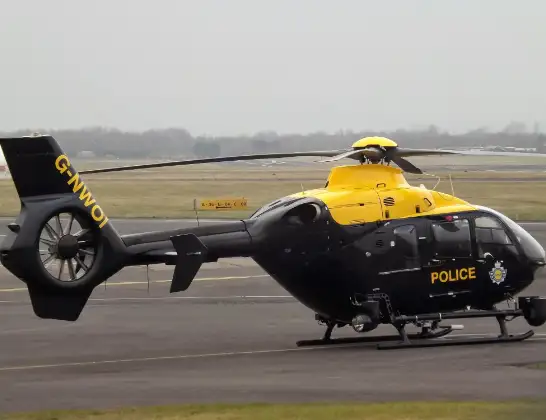
Helicopter: G-NWOI
The helicopter G-NWOI is used by the British police. The helicopter is deployed in pursuits, missing persons cases and other incidents where a helicopter provides added value.
Photo: James from Cheltenham
51 miles
1125 feet
208 mph
15 minutes
23:47
00:01

Route
Gwynedd Gardens, Swansea00:01
Mayhill, Swansea00:01
Cefn Glas, Bridgend23:54
Laleston, Bridgend23:54
Kenfig Hill, Bridgend23:53
Cefn Cribwr, Bridgend23:52
Laleston, Bridgend23:52
Broadlands, Bridgend23:51
Merthyr Mawr, Bridgend23:51
Ewenny, Vale of Glamorgan23:50
St. Brides Major, Vale of Glamorgan23:50
Llandow, Vale of Glamorgan23:49
Llantwit Major, Vale of Glamorgan23:49
RAF Llandow, Llandow, Vale of Glamorgan23:48
Llantwit Major, Vale of Glamorgan23:48
Sigingstone, Vale of Glamorgan23:48
Llanmaes, Vale of Glamorgan23:47
Bristol Channel, 23:47
Live flights
Today
Flights Mayhill
Air Ambulance Helicopter to Cardiff Heliport14 Jul 16:52
Air Ambulance Helicopter to Mayhill, Gors Avenue14 Jul 16:17
Police Helicopter to Mayhill, Heol-y-Gors26 Apr 13:18
Police Helicopter to Mayhill, Hewson Street22 Apr 14:39
Police Helicopter to MOD St Athan18 Apr 00:02
Police Helicopter to Mayhill, Gwynedd Gardens17 Apr 23:47
Helicopter flights on your website?
You can easily display helicopter flights on your own website. Use the embed code.
