Air Ambulance Helicopter to Gillingham, Shaftesbury Road
Thursday, 16 April 2026 | 22:15 | From New Forest
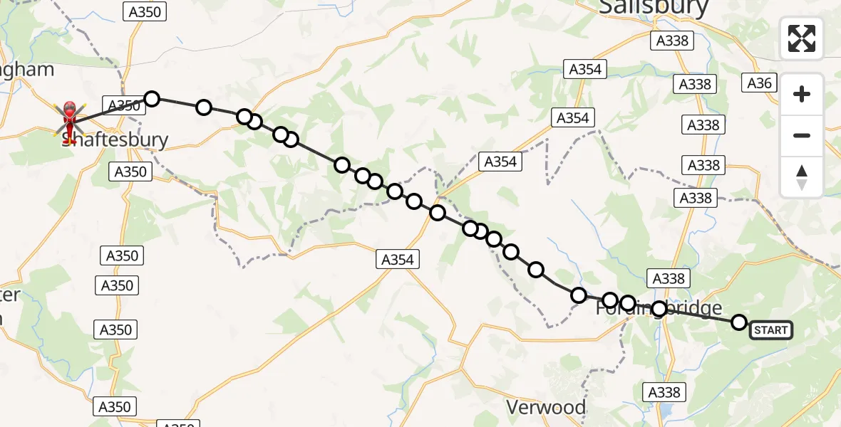
On Thursday, 16 April 2026 at 22:15, a Air Ambulance Helicopter departed from New Forest to Gillingham. It was the Air Ambulance Helicopter with registration number G-DSAA. The flight lasted 15 minutes. During that period, the aircraft travelled 24 miles at an average speed of 96 miles per hour at a maximum altitude of 2825 feet.
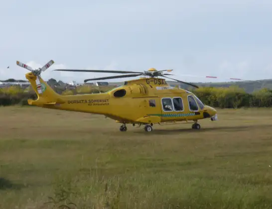
Helicopter: G-DSAA
The helicopter G-DSAA is used as a air ambulance helicopter. The main purpose of this aircraft is to transport a Mobile Medical Team to an incident as quickly as possible, enabling the trauma doctor to provide immediate first aid on site. The aircraft is flying this flight as Air Ambulance Helicopter.
Photo: Andrew Bone
25 miles
2825 feet
96 mph
16 minutes
22:15
22:31

Route
Shaftesbury Road, Dorset22:31
Donhead St. Mary, Wiltshire22:29
Donhead St Mary, Wiltshire22:28
Donhead St Andrew, Wiltshire22:27
Ansty, Wiltshire22:27
Berwick St. John, Wiltshire22:27
Berwick St John, Wiltshire22:26
Alvediston, Wiltshire22:25
Ebbesborne Wake, Wiltshire22:25
Bowerchalke, Wiltshire22:24
Bowerchalke Airfield, Bowerchalke22:24
Bowerchalke, Dorset22:24
New Forest, Dorset22:23
Sixpenny Handley and Pentridge, Dorset22:22
Martin, Hampshire22:22
New Forest, Hampshire22:22
Martin, Hampshire22:21
New Forest, Hampshire22:21
Damerham, Hampshire22:20
Alderholt, Dorset22:19
Sandleheath, Hampshire22:19
Fordingbridge, Hampshire22:18
Frogham, Hampshire22:16
New Forest, Hampshire22:15
Live flights
Today
Flights Gillingham
Coastguard Helicopter to Chatham, Lines Terrace31 May 18:21
Coastguard Helicopter to Gillingham31 May 17:47
Helicopter flights on your website?
You can easily display helicopter flights on your own website. Use the embed code.
