Air Ambulance Helicopter to Collyhurst, Boyle Street
Thursday, 16 April 2026 | 12:50 | From Manchester Barton Aerodrome
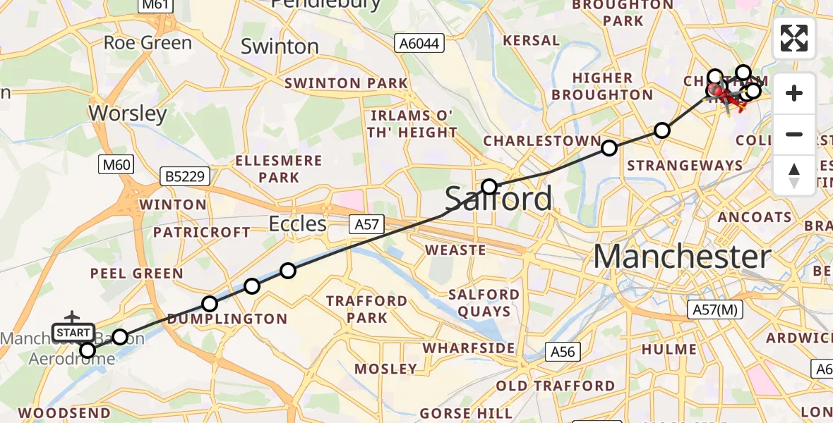
On Thursday, 16 April 2026 at 12:50, a Air Ambulance Helicopter departed from Manchester Barton Aerodrome to Collyhurst. It was the Air Ambulance Helicopter with registration number G-NWEM. The flight lasted 6 minutes. During that period, the aircraft travelled 9 miles at an average speed of 93 miles per hour at a maximum altitude of 1125 feet.
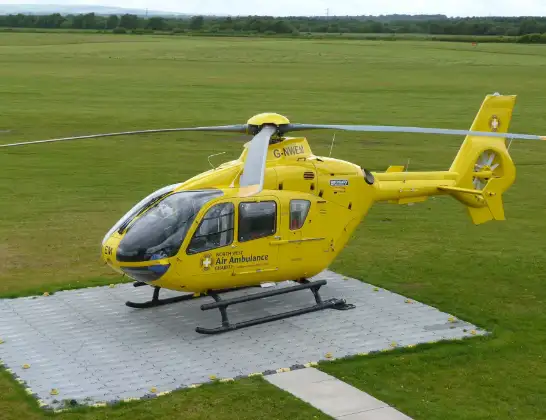
Helicopter: G-NWEM
The helicopter G-NWEM is used as a air ambulance helicopter. The main purpose of this aircraft is to transport a Mobile Medical Team to an incident as quickly as possible, enabling the trauma doctor to provide immediate first aid on site. The aircraft is flying this flight as Air Ambulance Helicopter.
Photo: Craig Sunter
10 miles
1125 feet
93 mph
7 minutes
12:50
12:56

Route
Boyle Street, Greater Manchester - Manchester12:56
Cheetham Hill, Manchester12:56
Collyhurst, Manchester12:55
Cheetham Hill, Manchester12:55
Strangeways, Manchester12:54
Collyhurst, Manchester12:54
Cheetham Hill, Manchester12:53
Strangeways, Manchester12:53
Lower Broughton, Salford12:53
Pendleton, Salford12:52
Eccles, Salford12:51
Dumplington, Trafford12:51
Eccles, Trafford12:51
Eccles, Salford12:50
Irlam, Salford12:50
Manchester Barton Aerodrome, Manchester, Greater Manchester12:50
Live flights
Police Helicopter on its way from MOD St Athan15 Jul 23:53
Police Helicopter on its way from Wrenthorpe15 Jul 23:36
Flights Collyhurst
Helicopter flights on your website?
You can easily display helicopter flights on your own website. Use the embed code.
