Air Ambulance Helicopter to Little Waltham, Chelmsford
Wednesday, 15 April 2026 | 15:36 | From Fulbourn
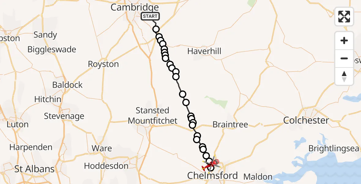
On Wednesday, 15 April 2026 at 15:36, a Air Ambulance Helicopter departed from Fulbourn to Little Waltham. It was the Air Ambulance Helicopter with registration number G-SCAA. The flight lasted 17 minutes. During that period, the aircraft travelled 35 miles at an average speed of 128 miles per hour at a maximum altitude of 1325 feet.
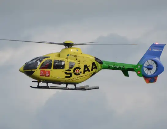
Helicopter: G-SCAA
The helicopter G-SCAA is used as a air ambulance helicopter. The main purpose of this aircraft is to transport a Mobile Medical Team to an incident as quickly as possible, enabling the trauma doctor to provide immediate first aid on site. The aircraft is flying this flight as Air Ambulance Helicopter.
Photo: Jonathan Payne
36 miles
1325 feet
128 mph
17 minutes
15:36
15:53

Route
Chelmsford, Essex15:53
Chelmsford, Essex15:52
Little Waltham, Essex15:51
Great Waltham, Essex15:50
Howe Street, Essex15:49
Pleshey, Essex15:49
Uttlesford, Essex15:48
Barnston, Essex15:48
Little Dunmow, Essex15:47
Uttlesford, Essex15:47
Great Dunmow, Essex15:47
Uttlesford, Essex15:46
Lindsell, Essex15:45
Thaxted, Essex15:44
Uttlesford, Essex15:42
Sewards End, Essex15:42
Ashdon, Essex15:42
Sewards End, Essex15:41
Little Walden, Essex15:40
Hadstock, Essex15:40
Uttlesford, Cambridgeshire15:40
Linton, Cambridgeshire15:40
Hildersham, Cambridgeshire15:39
Great Abington, Cambridgeshire15:39
Little Abington, Cambridgeshire15:38
Babraham, Cambridgeshire15:38
Cambridge Road, Cambridgeshire15:36
Live flights
Today
Flights Fulbourn
Helicopter flights on your website?
You can easily display helicopter flights on your own website. Use the embed code.
