Air Ambulance Helicopter to Blackfen, Danson Lane
Wednesday, 15 April 2026 | 12:43 | From City of Westminster
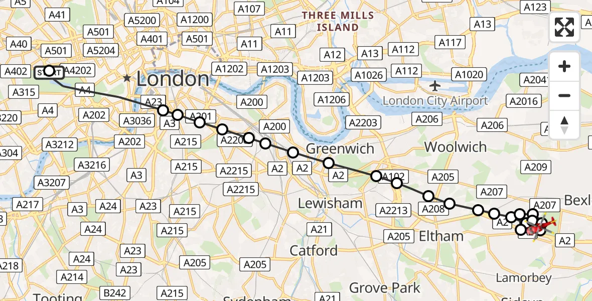
On Wednesday, 15 April 2026 at 12:43, a Air Ambulance Helicopter departed from City of Westminster to Blackfen. It was the Air Ambulance Helicopter with registration number G-LAAB. The flight lasted 9 minutes. During that period, the aircraft travelled 15 miles at an average speed of 96 miles per hour at a maximum altitude of 900 feet.
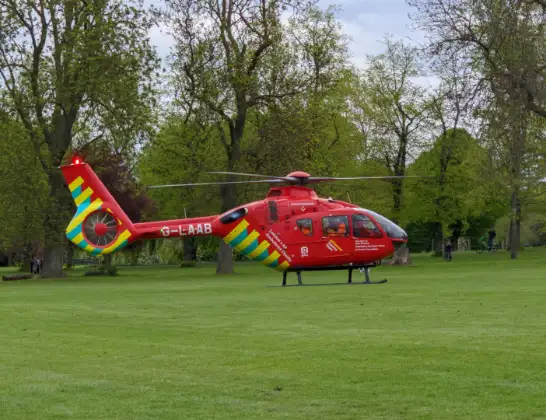
Helicopter: G-LAAB
The helicopter G-LAAB is used as a air ambulance helicopter. The main purpose of this aircraft is to transport a Mobile Medical Team to an incident as quickly as possible, enabling the trauma doctor to provide immediate first aid on site. The aircraft is flying this flight as Air Ambulance Helicopter.
Photo: Celsoazevedo
15 miles
900 feet
96 mph
10 minutes
12:43
12:52

Route
Danson Lane, Greater London - Bexley12:52
Blackfen, Bexley12:51
Welling, Bexley12:51
Blackfen, Bexley12:51
Welling, Bexley12:50
Falconwood, Bexley12:50
Sidcup, Bexley12:50
Blackfen, Bexley12:49
Falconwood, Bexley12:49
Avery Hill, Bexley12:49
Avery Hill, Greenwich12:49
Shooters Hill, Greenwich12:48
Well Hall, Greenwich12:48
Kidbrooke, Greenwich12:48
Kidbrooke, Lewisham12:47
East Greenwich, Greenwich12:47
New Cross, Lewisham12:46
Lidl, Lewisham12:46
Lidl, Southwark12:46
Walworth, Southwark12:45
Old Kent Road, Southwark12:45
The Borough, Southwark12:45
Elephant and Castle, Southwark12:45
City of Westminster, Westminster12:43
West Carriage Drive, Greater London - Westminster12:43
Live flights
Police Helicopter on its way from Brandy Carr14 Jul 22:00
Today
Air Ambulance Helicopter to Cardiff Heliport14 Jul 22:43
Coastguard Helicopter to North Sea14 Jul 22:40
Air Ambulance Helicopter to North Sea14 Jul 22:27
Air Ambulance Helicopter to Priory Farm Airstrip14 Jul 22:16
Air Ambulance Helicopter to Papworth Hospital14 Jul 22:02
Air Ambulance Helicopter to Redhill Aerodrome14 Jul 21:58
Coastguard Helicopter to North Sea14 Jul 21:56
Flights Blackfen
Helicopter flights on your website?
You can easily display helicopter flights on your own website. Use the embed code.
