Air Ambulance Helicopter to Stanton-in-Peak, Stantonhall Lane
Tuesday, 14 April 2026 | 13:12 | From Widmerpool
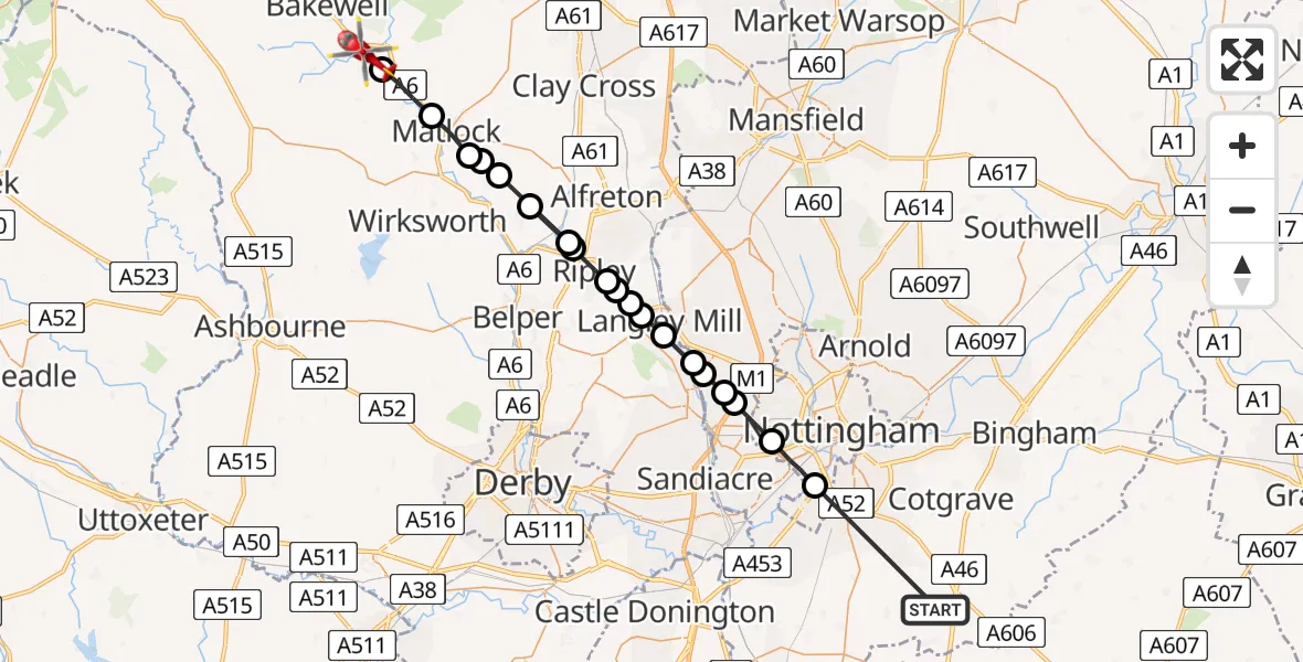
On Tuesday, 14 April 2026 at 13:12, a Air Ambulance Helicopter departed from Widmerpool to Stanton-in-Peak. It was the Air Ambulance Helicopter with registration number G-DRLA. The flight lasted 11 minutes. During that period, the aircraft travelled 38 miles at an average speed of 205 miles per hour at a maximum altitude of 1550 feet.
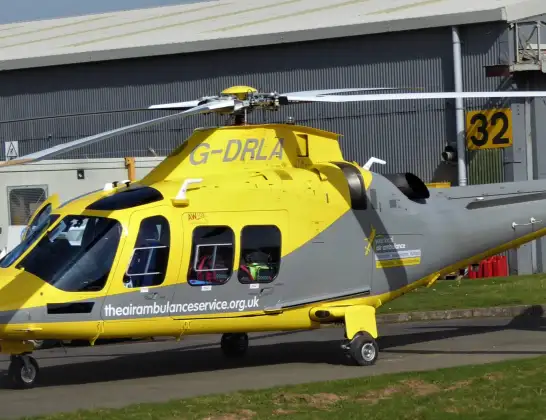
Helicopter: G-DRLA
The helicopter G-DRLA is used as an ambulance helicopter. The helicopter is equipped with a stretcher for transporting patients. The helicopter is often used to transport to hospitals.
Photo: Alec Wilson
39 miles
1550 feet
205 mph
12 minutes
13:12
13:24

Route
Stantonhall Lane, Derbyshire13:24
Tinkersley, Derbyshire13:23
Darley Dale, Derbyshire13:22
Matlock, Derbyshire13:22
Dethick, Derbyshire13:22
Holloway, Derbyshire13:21
Pentrich CP, Derbyshire13:21
Crich CP, Derbyshire13:21
Pentrich CP, Derbyshire13:20
Ripley, Derbyshire13:19
Codnor CP, Derbyshire13:19
Loscoe, Derbyshire13:19
Heanor, Derbyshire13:18
Langley Mill, Derbyshire13:18
Ilkeston, Nottinghamshire13:17
Awsworth, Nottinghamshire13:17
Cossall, Nottinghamshire13:17
Trowell, Nottinghamshire13:17
Wollaton, Nottingham13:16
City of Nottingham, Nottingham13:15
Penn Lane, Nottinghamshire13:12
Today
Flights Stanton-in-Peak
Flights Widmerpool
Air Ambulance Helicopter to Widmerpool, A4610 Jul 19:51
Air Ambulance Helicopter to Ilkeston, Derby Road10 Jul 18:39
Air Ambulance Helicopter to Swarkestone CP, A5010 Jul 16:33
Air Ambulance Helicopter to Widmerpool, A4610 Jul 14:06
Air Ambulance Helicopter to Hickling, A468 Jul 11:05
Air Ambulance Helicopter to Hickling, A467 Jul 20:23
Helicopter flights on your website?
You can easily display helicopter flights on your own website. Use the embed code.
