Coastguard Helicopter to Ventnor, Sandrock Road
Monday, 13 April 2026 | 19:42 | From Solent Airport
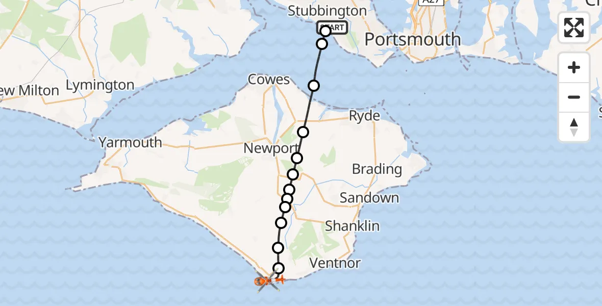
On Monday, 13 April 2026 at 19:42, a Coastguard Helicopter departed from Solent Airport to Ventnor. It was the Coastguard Helicopter with registration number G-RESF. The flight lasted 18 minutes. During that period, the aircraft travelled 17 miles at an average speed of 57 miles per hour at a maximum altitude of 1350 feet.

Helicopter: G-RESF
The helicopter G-RESF is used by the British Coastguard. The helicopter is deployed in search and rescue operations at sea, rescue operations involving ships or drilling platforms, patrols to prevent smuggling or piracy, environmental monitoring and disaster relief support.
Photo: Tony Melony
18 miles
1350 feet
57 mph
19 minutes
19:42
20:00

Route
Sandrock Road, Isle of Wight20:00
Ventnor, Isle of Wight19:59
Niton and Whitwell, Isle of Wight19:58
Godshill, Isle of Wight19:57
Rookley, Isle of Wight19:57
Rookley Green, Isle of Wight19:57
Merstone, Isle of Wight19:56
Blackwater, Isle of Wight19:56
Arreton, Isle of Wight19:55
Newport, Isle of Wight19:55
Wootton Bridge, Isle of Wight19:53
English Channel19:52
Stubbington, Hampshire19:51
Stubbington, Hampshire19:51
Solent Airport, Gosport, Hampshire19:42
Live flights
Today
Flights Ventnor
Coastguard Helicopter to Solent Airport30 Jun 16:32
Coastguard Helicopter to Ventnor, Sandrock Road13 Apr 20:01
Coastguard Helicopter to Ventnor, Sandrock Road13 Apr 19:42
Coastguard Helicopter to Solent Airport5 Apr 21:37
Coastguard Helicopter to Ventnor5 Apr 21:17
Coastguard Helicopter to Ventnor, Love Lane23 Feb 00:23
Helicopter flights on your website?
You can easily display helicopter flights on your own website. Use the embed code.
