Air Ambulance Helicopter to Claines, Droitwich Road
Monday, 13 April 2026 | 15:27 | From Metchley
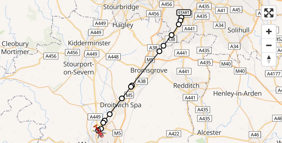
On Monday, 13 April 2026 at 15:27, a Air Ambulance Helicopter departed from Metchley to Claines. It was the Air Ambulance Helicopter with registration number G-OMAA. The flight lasted 10 minutes. During that period, the aircraft travelled 21 miles at an average speed of 127 miles per hour at a maximum altitude of 1575 feet.
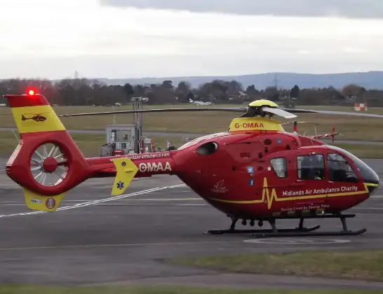
Helicopter: G-OMAA
The helicopter G-OMAA is used as a air ambulance helicopter. The main purpose of this aircraft is to transport a Mobile Medical Team to an incident as quickly as possible, enabling the trauma doctor to provide immediate first aid on site. The aircraft is flying this flight as Air Ambulance Helicopter.
Photo: James from Cheltenham, Gloucestershire
21 miles
1575 feet
127 mph
10 minutes
15:27
15:36

Route
Droitwich Road, West Midlands - Worcestershire15:36
Claines, Worcestershire15:36
Fernhill Heath, Worcestershire15:36
Claines, Worcestershire15:35
Fernhill Heath, Worcestershire15:35
Ladywood, Worcestershire15:34
Salwarpe, Worcestershire15:34
Droitwich Spa, Worcestershire15:33
Wychbold, Worcestershire15:32
Upton Warren, Worcestershire15:32
Bromsgrove, Worcestershire15:29
Rednal, Worcestershire15:29
Rednal, Birmingham15:28
Turves Green, Birmingham15:27
Shenley Fields, Birmingham15:27
Bushwood Road, West Midlands - Birmingham15:27
Metchley, West Midlands - Birmingham15:27
Live flights
Today
Flights Claines
Flights Metchley
Helicopter flights on your website?
You can easily display helicopter flights on your own website. Use the embed code.
