Coastguard Helicopter to Bempton
Monday, 13 April 2026 | 13:00 | From Humberside Airport
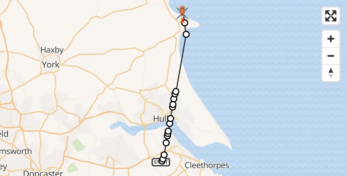
On Monday, 13 April 2026 at 13:00, a Coastguard Helicopter departed from Humberside Airport to Bempton. It was the Coastguard Helicopter with registration number G-MCGE. The flight lasted 19 minutes. During that period, the aircraft travelled 42 miles at an average speed of 135 miles per hour at a maximum altitude of 1025 feet.
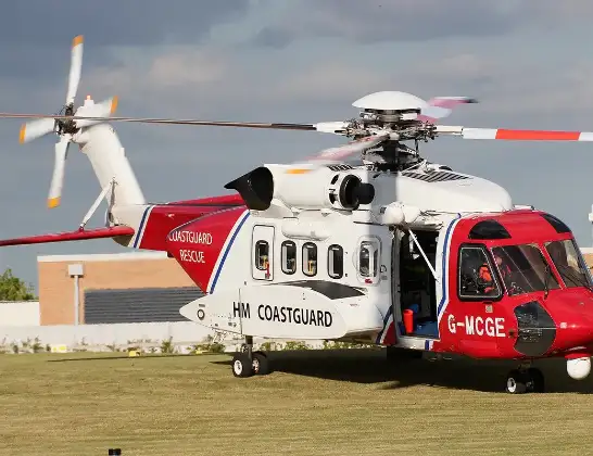
Helicopter: G-MCGE
The helicopter G-MCGE is used by the British Coastguard. The helicopter is deployed in search and rescue operations at sea, rescue operations involving ships or drilling platforms, patrols to prevent smuggling or piracy, environmental monitoring and disaster relief support.
Photo: Mike Burdett
42 miles
1025 feet
135 mph
19 minutes
13:00
13:19

Route
Bempton, East Riding of Yorkshire13:19
Bempton, East Riding of Yorkshire13:15
Bridlington, East Riding of Yorkshire13:13
Great Hatfield, East Riding of Yorkshire13:08
New Ellerby, East Riding of Yorkshire13:07
Skirlaugh, East Riding of Yorkshire13:07
Swine, East Riding of Yorkshire13:06
Hull, East Riding of Yorkshire13:06
Hull, Kingston upon Hull, City of13:05
North Sea13:04
Goxhill, North Lincolnshire13:04
South End, North Lincolnshire13:03
Barrow-upon-Humber, North Lincolnshire13:03
East Halton, North Lincolnshire13:02
Ulceby, North Lincolnshire13:01
Kirmington, North Lincolnshire13:01
West Lindsey, Lincolnshire13:00
Great Limber CP, North Lincolnshire13:00
Live flights
Police Helicopter on its way from Dundrod12 Jul 22:50
Today
Police Helicopter to East Ardsley, Stoney Lane12 Jul 23:51
Police Helicopter to Birmingham Airport12 Jul 23:46
Air Ambulance Helicopter to Newlands of Culloden12 Jul 23:24
Flights Bempton
Coastguard Helicopter to Humberside Airport13 Apr 13:34
Coastguard Helicopter to Bempton13 Apr 13:30
Coastguard Helicopter to Bempton13 Apr 13:19
Coastguard Helicopter to Bempton13 Apr 13:00
Coastguard Helicopter to Humberside Airport2 Apr 21:27
Coastguard Helicopter to Humberside Airport24 Feb 19:00
Coastguard Helicopter to Bempton, Nature Trail24 Feb 18:11
Helicopter flights on your website?
You can easily display helicopter flights on your own website. Use the embed code.
