Air Ambulance Helicopter to Padiham, Wordsworth Avenue
Sunday, 12 April 2026 | 9:55 | From Blackpool Airport
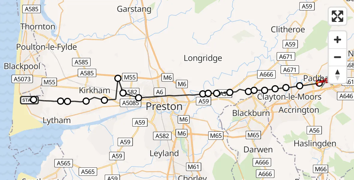
On Sunday, 12 April 2026 at 9:55, a Air Ambulance Helicopter departed from Blackpool Airport to Padiham. It was the Air Ambulance Helicopter with registration number G-NWAA. The flight lasted 11 minutes. During that period, the aircraft travelled 33 miles at an average speed of 182 miles per hour at a maximum altitude of 1900 feet.
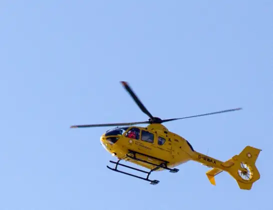
Helicopter: G-NWAA
The helicopter G-NWAA is used as a air ambulance helicopter. The main purpose of this aircraft is to transport a Mobile Medical Team to an incident as quickly as possible, enabling the trauma doctor to provide immediate first aid on site. The aircraft is flying this flight as Air Ambulance Helicopter.
Photo: David P Howard
34 miles
1900 feet
182 mph
12 minutes
09:55
10:06

Route
Wordsworth Avenue, Lancashire10:06
Padiham, Lancashire10:05
Altham, Lancashire10:05
Clayton-le-Moors, Lancashire10:04
Great Harwood, Lancashire10:04
Rishton, Lancashire10:03
Wilpshire, Lancashire10:03
Salesbury, Lancashire10:03
Mellor, Lancashire10:02
Balderstone, Lancashire10:02
Ribble Valley, Lancashire10:01
Samlesbury, Lancashire10:01
Preston, Lancashire09:59
Clifton, Lancashire09:59
Woodplumpton, Lancashire09:58
Newton-with-Scales, Lancashire09:58
Fylde, Lancashire09:57
Wrea Green, Lancashire09:56
Fylde, Lancashire09:56
Lytham St Annes, Lancashire09:55
Blackpool Airport, Blackpool09:55
Live flights
Today
Flights Padiham
Police Helicopter to Padiham, St Anne's Street19 Apr 20:19
Air Ambulance Helicopter to Blackpool Airport18 Apr 16:11
Police Helicopter to Irlam, Port Salford Way21 Jan 20:50
Helicopter flights on your website?
You can easily display helicopter flights on your own website. Use the embed code.
