Air Ambulance Helicopter to Helmshore, Musbury Road
Saturday, 11 April 2026 | 17:34 | From Blackpool Airport
On Saturday, 11 April 2026 at 17:34, a Air Ambulance Helicopter departed from Blackpool Airport to Helmshore. It was the Air Ambulance Helicopter with registration number G-NWAA. The flight lasted 12 minutes. During that period, the aircraft travelled 30 miles at an average speed of 145 miles per hour at a maximum altitude of 2200 feet.
Helicopter: G-NWAA
The helicopter G-NWAA is used as a air ambulance helicopter. The main purpose of this aircraft is to transport a Mobile Medical Team to an incident as quickly as possible, enabling the trauma doctor to provide immediate first aid on site. The aircraft is flying this flight as Air Ambulance Helicopter.
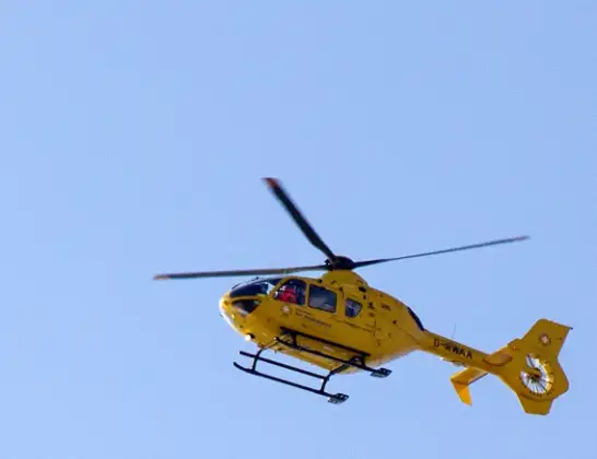
Photo: David P Howard
30 miles
2200 feet
145 mph
13 minutes
17:34
17:46

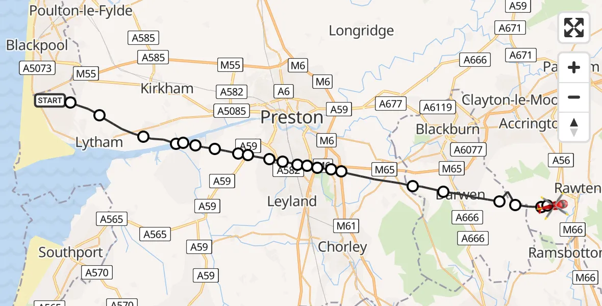
Route
Musbury Road, Lancashire17:46
Helmshore, Lancashire17:46
Haslingden, Lancashire17:46
North Turton, Blackburn with Darwen17:45
Hoddlesden, Blackburn with Darwen17:45
Darwen, Blackburn with Darwen17:44
Tockholes, Blackburn with Darwen17:43
Chorley, Lancashire17:41
Leyland, Lancashire17:41
Chorley, Lancashire17:41
Bamber Bridge, Lancashire17:41
Lostock Hall, Lancashire17:40
Farington Moss, Lancashire17:40
Whitestake, Lancashire17:40
New Longton, Lancashire17:39
Hutton, Lancashire17:39
Longton, Lancashire17:38
South Ribble, Lancashire17:38
Fylde, Lancashire17:38
Freckleton, Lancashire17:38
Warton Aerodrome, Warton17:37
Lytham, Lancashire17:36
Lytham St Annes, Lancashire17:35
Blackpool Airport, Blackpool17:34
Live flights
Police Helicopter on its way from East Ardsley11 Apr 22:12
Today
Coastguard Helicopter to Inner Seas11 Apr 22:20
Police Helicopter to Harborough, Sulby Road11 Apr 22:19
Coastguard Helicopter to Inverness Airport11 Apr 22:04
Coastguard Helicopter to Stornoway Airport11 Apr 22:02
Coastguard Helicopter to Inner Seas11 Apr 21:44
Police Helicopter to Sudbury Hill, Butler Road11 Apr 21:40
Coastguard Helicopter to Torrlaoighseach11 Apr 21:39
Flights Helmshore
Air Ambulance Helicopter to Blackpool Airport11 Apr 18:38
Helicopter flights on your website?
You can easily display helicopter flights on your own website. Use the embed code.
