Police Helicopter to Harborough, Sulby Road
Saturday, 11 April 2026 | 22:19 | From Husbands Bosworth
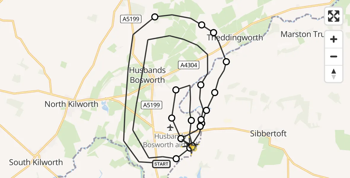
On Saturday, 11 April 2026 at 22:19, a Police Helicopter departed from Husbands Bosworth to Harborough. It was the Police Helicopter with registration number G-EMID. The flight lasted 16 minutes. During that period, the aircraft travelled 17 miles at an average speed of 61 miles per hour at a maximum altitude of 1925 feet.
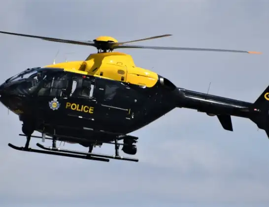
Helicopter: G-EMID
The helicopter G-EMID is used by the British police. The helicopter is deployed in pursuits, missing persons cases and other incidents where a helicopter provides added value.
Photo: Alec Wilson
17 miles
1925 feet
61 mph
17 minutes
22:19
22:35

Route
Sulby Road, Leicestershire22:35
Harborough, Leicestershire22:35
Harborough, West Northamptonshire22:35
Sibbertoft, West Northamptonshire22:34
Harborough, Leicestershire22:33
Harborough, West Northamptonshire22:33
Husbands Bosworth Airfield, Lutterworth, Leicestershire22:30
Harborough, West Northamptonshire22:29
Sibbertoft, West Northamptonshire22:29
Husbands Bosworth, Leicestershire22:26
Sulby Airstrip, Lutterworth, Leicestershire22:25
Harborough, West Northamptonshire22:23
Sibbertoft, West Northamptonshire22:23
Marston Trussell, West Northamptonshire22:23
Husbands Bosworth, Leicestershire22:22
Theddingworth, Leicestershire22:22
Husbands Bosworth, Leicestershire22:21
Mowsley, Leicestershire22:21
Welford Road, Leicestershire22:19
Live flights
Today
Flights Harborough
Police Helicopter to Harborough, Sulby Road13 Jul 23:36
Police Helicopter to Harborough, Sulby Road13 Jul 21:30
Police Helicopter to Harborough, Sulby Road13 Jul 17:25
Police Helicopter to Harborough, Sulby Road12 Jul 22:20
Police Helicopter to Harborough, Sulby Road12 Jul 20:10
Police Helicopter to Harborough, Sulby Road12 Jul 18:05
Police Helicopter to Harborough, Sulby Road11 Jul 22:29
Police Helicopter to Harborough, Sulby Road11 Jul 19:42
Police Helicopter to Harborough, Sulby Road10 Jul 21:35
Police Helicopter to Harborough, Sulby Road10 Jul 12:05
Helicopter flights on your website?
You can easily display helicopter flights on your own website. Use the embed code.
