Police Helicopter to Pontardawe, Gellyfowy Road
Saturday, 11 April 2026 | 0:51 | From MOD St Athan
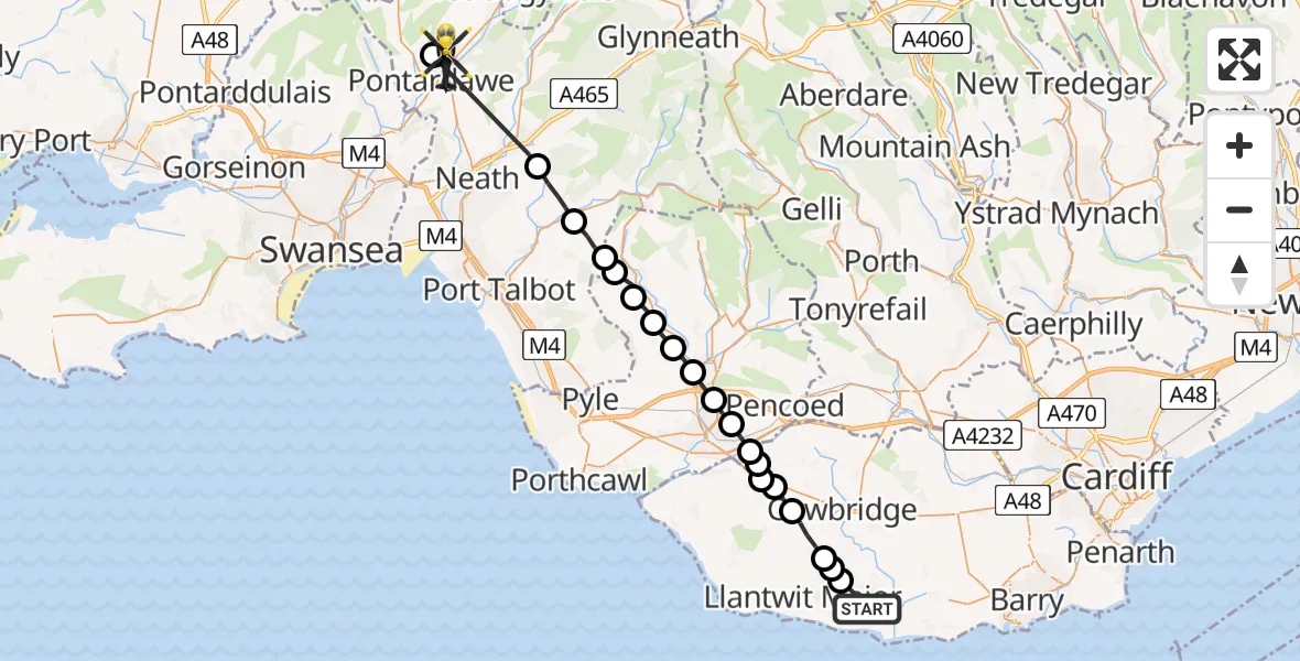
On Saturday, 11 April 2026 at 0:51, a Police Helicopter departed from MOD St Athan to Pontardawe. It was the Police Helicopter with registration number G-NWOI. The flight lasted 18 minutes. During that period, the aircraft travelled 32 miles at an average speed of 105 miles per hour at a maximum altitude of 2850 feet.
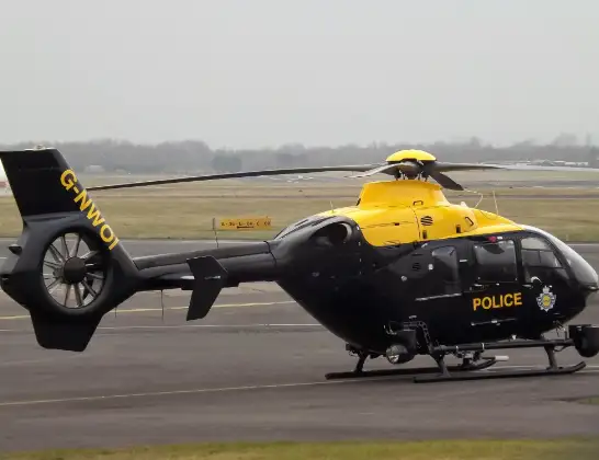
Helicopter: G-NWOI
The helicopter G-NWOI is used by the British police. The helicopter is deployed in pursuits, missing persons cases and other incidents where a helicopter provides added value.
Photo: James from Cheltenham
32 miles
2850 feet
105 mph
19 minutes
00:51
01:09

Route
Gellyfowy Road, Neath Port Talbot01:09
Pontardawe, Neath Port Talbot01:03
Tonna, Neath Port Talbot01:00
Ton-Mawr, Neath Port Talbot00:59
Bryn, Neath Port Talbot00:59
Maesteg, Bridgend00:58
Cwmfelin, Bridgend00:58
Llangynwyd, Bridgend00:57
Coytrahen, Bridgend00:57
Tondu, Bridgend00:56
Bridgend, Bridgend00:56
Coity, Bridgend00:55
Coychurch, Bridgend00:55
Treoes, Vale of Glamorgan00:55
Colwinston, Vale of Glamorgan00:54
Llangan, Vale of Glamorgan00:54
Llysworney, Vale of Glamorgan00:54
Sigingstone, Vale of Glamorgan00:53
Llanmaes, Vale of Glamorgan00:52
Eglwys Brewis, Vale of Glamorgan00:52
MOD St Athan, St Athan, Vale of Glamorgan00:51
Live flights
Today
Flights Pontardawe
Police Helicopter to MOD St Athan11 Apr 01:18
Police Helicopter to Pontardawe, Heol Las11 Apr 01:15
Police Helicopter to Pontardawe, Heol Las11 Apr 01:10
Police Helicopter to Pontardawe, Gellyfowy Road11 Apr 00:51
Helicopter flights on your website?
You can easily display helicopter flights on your own website. Use the embed code.
