Police Helicopter to Wrenthorpe, Stoney Lane
Thursday, 9 April 2026 | 1:13 | From Woodkirk
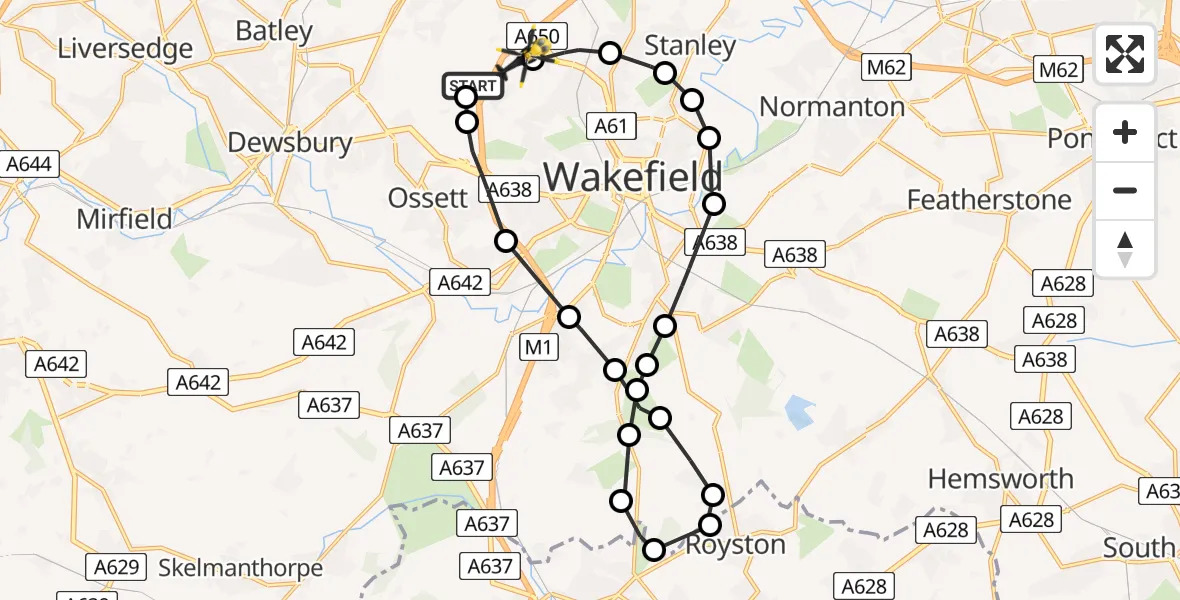
On Thursday, 9 April 2026 at 1:13, a Police Helicopter departed from Woodkirk to Wrenthorpe. It was the Police Helicopter with registration number G-POLB. The flight lasted 10 minutes. During that period, the aircraft travelled 20 miles at an average speed of 125 miles per hour at a maximum altitude of 1400 feet.
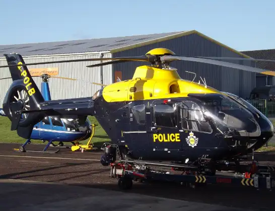
Helicopter: G-POLB
The helicopter G-POLB is used by the British police. The helicopter is deployed in pursuits, missing persons cases and other incidents where a helicopter provides added value.
Photo: James from Cheltenham, Gloucestershire
21 miles
1400 feet
125 mph
10 minutes
01:13
01:23

Route
Stoney Lane, West Yorkshire - Wakefield01:23
Wrenthorpe, Wakefield01:23
Newton Hill, Wakefield01:22
Stanley, Wakefield01:21
Heath, Wakefield01:21
Kirkthorpe, Wakefield01:21
Heath, Wakefield01:20
Walton, Wakefield01:20
Kettlethorpe, Wakefield01:19
Newmillerdam, Wakefield01:19
Notton, Wakefield01:19
Woolley, Wakefield01:18
Barnsley, Barnsley01:18
Royston, Barnsley01:18
Royston, Wakefield01:17
Notton, Wakefield01:17
Newmillerdam, Wakefield01:16
Durkar, Wakefield01:16
Horbury, Wakefield01:15
M1, West Yorkshire - Wakefield01:14
Woodkirk, Leeds01:14
Woodkirk, West Yorkshire - Leeds01:13
Live flights
Today
Flights Wrenthorpe
Police Helicopter to Brandy Carr, Stoney Lane28 May 13:24
Police Helicopter to Brandy Carr, Stoney Lane21 May 15:38
Police Helicopter to Wrenthorpe, Stoney Lane12 May 23:51
Police Helicopter to Wrenthorpe, Stoney Lane12 May 21:36
Police Helicopter to Wrenthorpe, Stoney Lane12 May 20:41
Police Helicopter to Wrenthorpe, Stoney Lane12 May 20:30
Police Helicopter to East Ardsley, Stoney Lane12 May 17:36
Police Helicopter to Wrenthorpe, Stoney Lane12 May 13:24
Police Helicopter to Wrenthorpe, Stoney Lane11 May 17:38
Police Helicopter to Wrenthorpe, M111 May 09:26
Flights Woodkirk
Police Helicopter to Brandy Carr, M126 May 20:28
Police Helicopter to East Ardsley, Stoney Lane22 May 10:50
Police Helicopter to Brandy Carr, Stoney Lane21 May 19:14
Police Helicopter to Marsden, Marsden Lane5 May 18:08
Police Helicopter to Woodkirk, M130 Apr 20:18
Police Helicopter to Woodkirk, M130 Apr 19:33
Police Helicopter to Wrenthorpe, M130 Apr 05:44
Police Helicopter to Woodkirk, M128 Apr 13:36
Helicopter flights on your website?
You can easily display helicopter flights on your own website. Use the embed code.
